
Doggerland as Atlantis? Perhaps?
3 posters
Miles Mathis' Charge Field :: Miles Mathis Charge Field :: Scientific Discoveries :: Just Out there....
Page 1 of 1

Doggerland as Atlantis? Perhaps?
![]() by Chromium6 Wed Nov 23, 2022 4:31 am
by Chromium6 Wed Nov 23, 2022 4:31 am
Just wanted to post this since there is sufficient evidence of a "Doggerland" in the last 25 years. Also ancient Egyptians referred to it as an actual "land" which upon a major society was built. Posted for fun...but I have relatives from the Orkney Islands that probably lived there at one point in the ancient past. Note this is all highly speculative. Egyptians descibed a lot of land mass...IMHO it was probably Doggerland than some small volcanic thrusted land mass in the Mediterranean. I bet if they go real deep with the submersibles...they'll see megalithic temples under the sea. Probably a lot more advanced and expansive than stonehenge. Sorry if this detracts from real "science".
They likely knew of the Wheel of Time on Doggerland.
---------
The "Great Plain" of Atlantis - was it in Doggerland?
The Atlantis of Jean Deruelle
The "true heart of Europe"
It was inevitable that Doggerland (See: Doggerland lost), the part of the North Sea which was left dry for several thousand years after the end of the last ice age, should come to be considered as one more possible location for Plato's Atlantis. Doggerland stretched all the way from the east coast of England and Scotland to Denmark and supported a thriving mesolithic population. "It was the true heart of Europe," says Richard Bates, geochemist at St Andrews University in Scotland. It struggled for several millennia against the rising sea levels, then was submerged in a sudden catastrophe at a date estimated between 6200 B.C. and 5500 B.C. (Maybe caused by, or connected to the Störegga Landslide). Robert Graves himself had briefly considered the area of shallows known as Dogger Bank as a possible location for Atlantis, before dismissing it on grounds of distance.
As it happens, more than a decade before geologists focused attention on Doggerland at a 2012 meeting of the British Royal Society, a Frenchman, Jean Deruelle, had published a book making a strongly argumented case for the notoriously elusive "Great Plain" of Atlantis having been situated on now submerged land in the North Sea. He published his hypotheses in 1999, in a book called "L'Atlantide des Mégalithes," as part of a broader examination of the spread of megalithic cultures and little studied West to East movements of populations. The book was published by a reputable publisher of historic books, but received scant attention.
Jean Deruelle was born in 1915 in Longueville (Nord) and studied at the elite French Ecole Polytechnique. He was the CEO of the French coal mining company, "Les Houillères de Lorraine." During his retirement, he indulged his life-long passion for Brittany and the megalithic civilizations of Europe. He died two years after the publication of "L'Atlantide des Mégalithes."
The location of the "Great Plain" has always been one of the biggest stumbling blocks for any Atlantis identification. Deruelle, an engineer and a geologist by profession, offers a hypothesis that is rational, highly precise, and based on his areas of expertise. No other hypothesis than Deruelle's tackles so credibly the most outlandish elements in Plato's description of Atlantis: the description of a vast plain, surrounded by a man-made ditch, 180 meters broad and thirty meters deep, large enough to circulate supertankers: it was not a ditch, but a dyke, build over centuries to protect a large part of Doggerland against the slowly rising waters of the North Sea... As for the literary form of his book, he chose a lighthearted approach, keeping to a semi-fictional threat of a wide-eyed, naive amateur, a character by the name of Thomas, who is learning as he goes along, and reporting to a chorus of bemused and sceptical relatives and friends.
When he is finally ready to sum up for them his new theory of Atlantis, he gathers them in his home in Platonic fashion, for a "Symposium," or a traditional French dinner.
We surmise that the reader is well informed of Plato's story of Atlantis and of its problems. All those who do not dismiss Plato's tale of Atlantis as a mere backdrop for politic-fiction, devoid of grounding in reality, know that there is a fundamental contradiction: because he presents the Atlanteans as engaged in a war of aggression against Athens and Egypt, one must chose either to follow the dating of the event as reported by Plato, who situates the catastrophic end of Atlantis around 9700 B.C., but then one must give up the idea of a war with Athens and Egypt as fiction, as neither of these powers existed at the time; or one choses to follow him on the legendary-historical war story but then, one must dismiss his dates.
Deruelle, who needs to have his Atlantis contemporaneous with the great megalithic civilizations, choses the dates of 7000 BC and 2600 BC for its beginning and its end. Earlier dates might have suited his thesis better, as the drowning of Doggerland is dated some 2500 years earlier, but this late date gives him an opportunity for interesting conjectures about the respective evolutions of the oceans levels and of the ground levels in this area of the North Sea over the past 20,000 years.
That astonishingly advanced civilizations can have existed elsewhere at the time which Plato (or the Egyptian priests who are his source) indicates for Atlantis, is being proven right now by the archaeological digs at Göbekli Tepe in Turkey, should their dating at 9200 BC indeed hold. But these, which have left the archaeological world dumbfounded, have come to our knowledge only recently, and Deruelle would surely have been enthusiastic, had he lived to hear about them.
Go to: "Doggerland Lost" on Q-Mag.org
Now, to make straight the aspect and dimensions of the "Great Plain," which we are referring to, according to Plato:
this plain had a level surface and was as a whole rectangular in shape, being 3000 stades (530 km = 330 miles) long on either side and 2000 stades (360 km = 225 miles) wide at its center, reckoning upwards from the sea. And this region, [Critias - 118b] all along the island, faced towards the South and was sheltered from the Northern blasts. And the mountains which surrounded it were at that time celebrated as surpassing all that now exist in number, magnitude and beauty; for they had upon them many rich villages of country folk, and streams and lakes and meadows which furnished ample nutriment to all the animals both tame and wild, and timber of various sizes and descriptions, abundantly sufficient for the needs of all and every craft. [Critias - 118c] Now as a result of natural forces, together with the labors of many kings which extended over many ages, the condition of the plain was this. It was originally a quadrangle, rectilinear for the most part, and elongated; and what it lacked of this shape they made right by means of a trench dug round about it. Now, as regards the depth of this trench and its breadth and length, it seems incredible that it should be so large as the account states, considering that it was made by hand, and in addition to all the other operations, but none the less we must report what we heard: it was dug out to the depth of a plethrum (ca. 30 m = almost exactly 100 feet) and to a uniform breadth of a stade (180 m = 196 yards), and since it was dug round the whole plain [Critias - 118d] its consequent length was 10,000 stades (1800 kilometers = 1120 miles).
If the dimensions of the Plain must appear awesome, nobody in his right mind can believe the veracity of these later numbers, relating to a man-made ditch! These are so far "off the chart" that they understandably undermine the credibility of all the other indications. Only Deruelle - or his alter ego Thomas - succeeds, at least, in making sense of them.
In front of his guests, gathered for apéritif, Thomas unfolds a map. The first task is to find a rectangle of 530 km by 360 km which could have stayed out of water until around 2600 BC.
Here is what north-western Europe looked like in 18,000 BC, at the end of an ice age which had lasted 70,000 years. You see, the doted line shows the present coastlines. The areas covered by the sea are in grey. The formation of ice at the expense of the oceans brought down the sea level by 120m.
We can see that the sea is 100 km to 150 km away from the present coastline of Brittany and Ireland. The English Channel and the Irish Sea were dry, but space is lacking there for our Great Plain. On the other hand, we find that the North Sea is dry all the way to the latitude of Scotland, 800km from the Netherlands, on a breadth of 500km separating England from Denmark.
A friend exclaims about the extreme flatness of this uncovered land:
"That's hardly believable! A one hundred meter rise can be swallowed in two minutes by car, and here, one would have to cover 800 km!"
"Unbelievable, indeed! All the way from the Netherlands, the ground rises only by a hand's breadth every kilometer! This is an exceptional 'geological case!' But it responds admirably to Plato's description of a Great Plain ‘flat and of a uniform level.'"
"No wonder man would have settled in such a vast territory!"
Northern Europe around 18,000 BC. The polar ice sheet was crushing Scandinavia, reaching Denmark and part of the North Sea, which had dried up all the way to the Orkney Islands, because of the 120 meter drop in sea level. The Scottish glacier covered the west of the North Sea. The retreating of the water pushed the Atlantic back 150 km from the present shores of Brittany.
The area was not very hospitable then! The map shows the extreme advance of the ice-sheets, well known from on-land, but less so under the sea. An enormous glacier two to three thousand meters thick covered the mountains of Norway and advanced on the North Sea. It's moraine formed the backbone of Denmark. Another glacier, less huge, crowned the mountains of Scotland and occupied the West of this area. It's only when the climate warmed up considerably in 10,000 BC that the area became inhabitable.
Moreover, there exists in this area a submerged island, namely the Dogger Bank.
Thomas unfolds another map, showing the level curves of the bottoms of the North Sea. They show an area of shallows of less than -35m, culminating at less than -18m, where marine maps signal dangerous breakers during storms. In the middle of the immense platitude of the plain, this elevation looks indeed like an island which the sea no doubt surrounded for a long time as it kept rising.
"These shallows are replete with fish and have been for centuries the rendez-vous of dutch fishing boats, called doggers, which gave it its name, the Dogger Bank."
How did this outcrop come to exist? The bottom of the North Sea has been planed by several ice ages in succession. The western face of the Dogger Bank is probably a moraine pushed there by the Scottish glacier. It has been deeply ravined by the movements of the water, which were forced to find their way around it. There are cliffs there, with a vertical drop from -20m to -40m. The north face is less abrupt but the ground still goes down quickly from -35m to -60 m.
This conforms to Plato's saying that the Plain dominated the sea by a vertical drop, and that on the other side of the drop, the Plain went down in a gentle slope, which is what we can make out. The Dogger Bank is prolonged, to the north-east, by elevations at -40m in the direction of the coast of Denmark.
Over drinks, the guests make two remarks: on the one hand, with its 300km on 100km, Dogger Bank was far from reaching the dimensions of the Great Plain of Plato. And then, one had to make sure that it was still out of water at the time of Atlantis, between 7000 B.C. and 3000 B.C.
The present North Sea bottom. Over 800 km, the ground slopes only 10cm per kilometer. In the middle, at -50m, there is a low rise, 20 m to 30 m high, 150 km long, 60 km broad, the Dogger Bank, which creates a hazard zone for navigation.
The opinions of the specialists on this matter, Thomas admit, have been utterly discouraging: they say that the Bank was already submerged by 6000 BC.
"Well, then..."
But I believe that I have found a flaw in the conclusions they draw from their observations. In order to make myself more clear, I had to resort to some calculations which I hope will not put you off too much...
The rise of sea levels since the last ice age, explains Thomas, has been of course of the utmost importance to Dutch geologists, their country having been conquered on the sea, and its defense against rising sea levels has been a continuous struggle. But this situation has made its fortune!
Because the soil is made of an extremely fertile peat, which formed itself slowly in fresh water marshes where it was held back, on a soil of a naturally feeble slope, behind a string of costal dunes, while the sea was rising. Radiacarbon dating has found of date of 6600 BC for the peat found at -19m, where it makes contact with the natural soil at the vertical of the coast, from which geologists have deduced that it was at that moment and at that level that the sea had reached the coast of Holland. All that would have emerged at that time of the Dogger Bank would have been an islet above the -19m line. Since then, and ever more slowly, the regular rise of the sea level has thickened the peat layer to its present level.
"That's bad, my dear Thomas! That's very bad for your Atlantis!"
Except that... continues Thomas, who has more charts at hand. There are curves which give the average of measures obtained by diverses techniques on all the oceans of the globe. They give an account of the general variation of the levels of the seas, called "eustatics." The inferior part shows (curve in full line) how the level of the oceans has gone up by 100 m since 14,000 BC.
You will notice that it is around 6000 BC, and not today, that the present level has been attained. The blown-up graphic below shows that this level was exceeded by 3m to 4m during the warm period of ca 4000 BC. Then we witness a series of oscillations, the dates of which are still not well known, but which tend generally to slow down.
Which doesn't mean that the Dutch scientists are wrong. It just happens that the same words don't always mean the same things. The Dutch, like most regional researchers, talk only about what they are able to measure: the variation of the present level of successive shorelines, the traces of which one can find in the soil at different periods.
But the level of the shorelines is different from the rise of the sea levels because, in any given point, the shoreline rises if the sea rises, but also when the ground subsides! And as it is difficult to measure the movements of the ground, there is a tendancy to consider them as negligible and to treat the shoreline curves as if they merged neatly with eustatics. There's a flaw there, says Thomas, which I deemed legitimate to explore.
"Let's see, says a guest. If the sea has reached its present level in 6000 BC, and if the Dutch find their coastline at -19m at that date, it means that their land has subsided by 19 meters!"
Geologists have been intrigued to find on several hundreds of meters on the flanks of Scandinavian mountains the traces of succesive shorelines. They conclude from it that the earth's crust has subsided by some 300m in the North of Sweden, under the enormous weight of nearly 3,000 meters of ice, hollowing out a kind of a bowl, the lips of which found back to the level zero near the limit of the glaciers. Beyond this "neutral line," the repressed magma had formed a "compensatory bulge" which elevated the earth's crust. Since 18,000 BC, the melting of the ice has had a reverse effect, the ground is going up in Scandinavia and down at the place of the bulge.
This going back to normal is not finished yet. Maps show the residual movements of the soil at the present time.
In Scandinavia, the curves of equal rise turn around the bottom of the "bowl" which is well marked in the North of the Gulf of Botnia. The ground goes up there by some 9mm/y. The rate diminishes as one moves away from it. The neutral line, with zero movement, cuts through the North of Denmark.
Beyond this neutral line, begin the residual subsidings of 1 to 2millimeter/y, even reaching 3mm at the mouth of the river Elbe. They draw the contours of the "bulge" which compensated for the subsiding of the bowl.
A 1mm/y subsidence may seem negligible, but it would add up to 8 meters in 8,000 years. And this is only one residual movement among the most important. Here's another place where a fault may have found its way into the reasoning of the scientists.
"So you've tried to reconstruct the state of the ground in 8000 BC?"
And even earlier, in 18,000 BC, when we know that the 300m subsidence of the Gulf of Botnia occurred. Let's look at this map which blows up the North Sea section. It shows the "official" curves, which stop neatly when reaching the coast, because scientists hesitate to guess what goes on under the sea, where they cannot rely on measures.
I took the risk of prolonging them as logically as possible. I hope that you will find the result elegant, at the least!
They are all impressed. One can see the lip of the Scandinavian bowl along the coast of Norway but also, in the west, the bowl of the Scottish glacier, which is still rising 3mm/y. One finds the neutral curves at 0, and then in the axis of the North Sea, the compensating bulge which subsides by 2mm to 3mm/y.
The North Sea bottom must then have been considerably higher than today!
The rise of the North Sea - The weight of the ice sheet had pushed down the soil in Norway and Scotland. A compensating bulge had formed between them. The melting induced opposite movements. The dotted line shows the rises (+) or drops (-) which are still to be made out along the shores. Their prolongation beneath the sea gives the outline of the "bulge" which lifted the soil. We indicate on these lines, between Scotland and Norway, an estimate of rises reached in 18,000 BC.
"Well, remarks his son in law, we know that the 9mm/y of the Gulf of Botnia are the residual movement of a 300m subsiding. At the same rate, the 3mm/y of the Dogger Bank should have lifted it up by 90m!"
One may find simplistic this law of proportionality, which attributes, since 18,000BC, a total movement of 33m, of which 1mm/y are occurring at the present time. It suffices to evaluate between the curves, the present number of mm/y of any point of the map, to know its rise at that time. We see that the ground of the North Sea, unchanged on the coast of Scotland and Norway, rose slowly to reach a level of 60m to the West of Dogger Bank and 90m to the east. It's considerable, and whatever the degree of uncertainty of the calculation, it's far from being negligible.
"Unfortunately, under the sea, nothing can be verified!"
Maybe that geology is giving us a hint by declaring to be "unexplainable," off the coast of Scotland, some north-south oriented ravines dropping to -200m, that is, 80m lower than where the sea was! Nothing surprising to that, if the soil was lifted up by that much. Rivers have dug their estuaries there.
You know enough to be able the draw the map of the North Sea in any year since 18,000 BC! To begin with, it is easy to find the reading of the present level of the sea bottom at any point of the map, by using a marine chart!
You now can also evaluate the number of mm/y of the present movement of the ground in this point by checking it on my map. The curve shows how the 33m per m/y of 18,000 BC have diminished through the years. For any date, you will find the residual rise, and, vertically below, the level of the seas. The math-heads among you will be able to verify how it works.
"Alright," mumbled a math-head. "But where do you get your negative growth curve from?"
Well, the geologists would have all elements at hand to establish it! Lacking it myself, I had to invent it! We know that changes have been very slow at the beginning. Between 18,000 BC and 14,000 BC, the "33m" would have gone down only little. We must also arrive at the present date with a slope of 1mm/y. Between the two... the measurements from Holland give me a rise of 16.5m in 6,600 BC (19m minus 2.5m of sea levels).
The guest go to dinner. When they return to the salon, a new map is shown.
On these bases, this is how the north-west of Europe presented itself in 7,000 BC., at a time when, according to Plato, "neither ships nor sailing were as yet in existence," (Critias 113e) and when Poseidon decided to protect his beautiful Clito from the sea and divided his land among their ten sons.
You see that the sea, in grey, 5m below its present level, licked the slopes of the Dogger Bank which dominated it by some 15m. [We might point out that it was probably more, on account of the erosion having occurred since.] Men, who had been moving back for a thousand years on a hopelessly flat terrain, found refuge on this mountain "of a mediocre altitude" but the sea began to encircle it by the north-east, where an outcropping was already almost isolated.
To the south-west, the sea infiltrated more deeply, penetrating in deep ravines which had been dug by the rivers forced to circumvent the Bank. To the south-east, the terrain found back to the weak slope of the natural soil.
Thomas' level curves bring to the fore some striking pecularities: in the direction of the mouth of the Elbe, the ground reaches a reading of +10, then of +14, to reach a vast outcropping at reading +30m, encompassing the whole valley of the nether Elbe. Beyond, it slopes down rapidly to the present level of the land. He concludes that the "bulge" which had been brought about by the ice-age had forced the Elbe and the Weser to divert their course to the West, probably in the direction of the Zuydersee... Where another surprise is in store: the map of the mm/y movements shows that the bulge prolonged itself towards the Pas-de-Calais. The +14 curve shows that there subsisted, along the Belgian coast, a "glove finger," which narrowed the access to the English Channel. But above all, this dam protected, in the east, a vast bowl formed, from the Schelde to the Zuydersee, by the natural soil which the thick layer of peat had not yet covered!
All these waters formed a huge swamp the exit of which, situated near Texel, the first of the Frisian islands, directed their flow towards the deep ravines observed at the south-west of the Bank, towards the channel of the Pas-de-Calais.
Thomas admitted that the geologists to whom he had submitted his idea had not rushed to congratulate him. Neither could they find fault with his reasoning.
The North Sea in -7000 BC. The Dogger Bank begins to be surrounded by the sea. Level +30 deviates the rivers Elbe, Weser and Ems towards a lake held in by level +14 in the Netherlands. The effluent digs the Silver Pit to the west of the Dogger Bank and, to the south, the ravine towards the Pas-de-Calais.
Now look at this map and decide what you would have done if you had lived in this country, ever more eaten up by the sea.
"The solution is known: build dykes!"
"But this would have been quite beyond the capacity of these isolated and unorganised tribes! They could only keep fleeing from the advancing sea..."
...and abandon the tombs of their dead, which for thousands of years, they had protected with the help of indestructible megaliths and barrows? But they had also organized themselves early in order to reinforce the dunes of the coast with embankments. All this would explain the discipline, the emergence of a sense of the common good and the taste for vast public works which one can surmise to have characterized the civilization of the megaliths, explains Thomas, waxing enthusiastic.
These people were accustomed to defending their territory. And the circumstances were particularly favorable! The Dogger Bank offered a natural bareer 15m high (or more...) and 300km long! It sufficed to reinforce it on its flanks.
Imagine the situation. A tribal chief, let's call him Atlas, has put up his hut at the highest point of the Dogger Bank, on top of a vertical cliff, from where he could survey the surroundings. He called on his neighbors: let's stop dispersing our strengths! You see there this enormous river which comes straight towards us to throw itself at our feet in this ravine through which the sea progresses? It suffices to erect, on our side of the river, an embankment, in order to protect in due time the whole plain which is behind. But all the tribes would have to send me a contingent of workers!
They all agreed that he was right, and that the realisation was not particularly difficult. An embankment of 3 meters would have brought protection for one hundred years. But there was a worse danger to avert. "I have explored this mountain until its tip, very far to the north. There too, the sea is beginning to infiltrate the plain through some kind of a valley, beyond which one can see, in the distance, a line of some elevations, which could also protect us. We should build there a big dam, which looks possible to me because, interestingly, there is no river in this valley! I suggest therefore to send a delegation to the tribes in the north so that they associate themselves in a solemn pact for the defense of our Plain!"
The pact was made. The chief got powers to bring to completion his program on the whole territory. They agreed that they would have to get into the good graces of the god of the sea, whose assaults would have to be brought under control. They would build for him a temple at the highest point, where a collegium of priests would honor him and try to figure out his intentions in order to provide guidance for the work to be done.
And that's how, concluded Thomas, in 7000 BC, a tremendous struggle might have been engaged in order to counter the rise of the waters!
And how an enterprising tribal chief was able to extend his authority over the vast lands of the megaliths.
To the South of the Dogger Bank, the battle-plan was laid out by the terrain itself. It sufficed to shore up the bank of the river, which was almost rectinilear, flowing on a very flat surface. As the sea rose, it had to be elevated, and prolonged towards the coast of Holland.
To the north, it was much more difficult to cut through the valley, an ancient bed of the diverted river Elbe. The dam was exposed to the terrible storms of the North Sea and would have to be prolonged by and by over 50 km.
Beyond, left-over moraines would have offered protection in the direction of the east; but the sea already infiltrated there through numerous ravines. So they decided to put their line of defense further back, on the flat land, which, to the south-east, rose gradually in the direction of Denmark.
The map of 7000 BC shows the line of these first dykes. And the result to which, guided by the configuration of the land and the evolution of climate and terrain, might have lead, by 3,000 BC, four thousand years later, a faitful continuation of these politics.
The Dogger Bank and its three dykes, in full lines, prevented the sea from invading this immense territory which extended all the way to today's coasts. Now, is this not a space which can pretend to the title of a "Great Plain"?
Taking a hold on the still emerged Dogger Bank, the Great Plain is spreading at 10 or 20 meters below sea-level, protected by mighty dykes. The continental waters are stopped by the shoring up of the Frisian and Danish islands. Behind this dam, the sea penetrates on the low-lands presently covered by a thick layer of peat. The ground of Denmark has not yet sunk back enough to allow the Elbe to find back to its bed.
I have calculated to which height , including a 5 meter keep, these works had to be raised. The most dramatic point was of course to the north, with a maximum of 35m, the crossing of the old Elbe bed. But between 20 and 30 meters would have sufficed in most points.
Dykes thirty meters high! protested someone. But this is enormous! Because one must calculate, at the summit, a breadth that is equal to the height! That would hold an autoroute! And then at the base, there's a rule of thumb, you need six times more, that's 180 meters! And all this on a length of 1000 kilometers, you must admit, it's hard to believe!"
"‘Hard to believe,'" indeed, that's exactly the expression employed by Plato.
Let's do as he does: let's pursue our calculations. At the most critical moment, around 5000 BC, when the sea is rising by 7m per millenium, one needs adding only 1.2 centimeter to the dykes every year in order to keep up with the rise of the waters, that's about 1 to 4 cubic meters of dirt per kilometer per day depending on the height. We must take into account the utter slowness of the process and the millennia at disposal.
Run-off waters and rivers would have been a major problem in such a huge area situated below sea-level. Long before 8000 BC, the "bulge" had diverted the Elbe and Weser rivers towards the great lake of the Netherlands, where they joined up with the Rhine. All these waters were evacuated near Texel, forming now a great river with firm banks. The Great Plain was rid of them!
By 3000 BC, the situation had become very different, as seen on the map. The sea had come closer to the exit of the lake, which the subsidence of the ground had made broader. The "great river" itself having been drowned, the soil became propitious to the formation of peat.
Forgive my vanity for finding here a confirmation of my theory of the "bulge!" It is the bulge which dammed the lake where the peat deposited. That's why one can't find any peat anywhere a few kilometers from the present coast, or anywhere at the bottom of the north sea!"
"Do geologists ignore the existence of this bulge?
They don't venture to look beneath the sea, where the absence of peat does not intrigue them! But they are perplexed by the formation of the Frisian islands, which follow the coast of Groningen from Texel, near the Zuydersee, all the way to the mouth of the Elbe. Practically at sea level, they protect a swamp which is filling up with peat. How could these islands have come about? They are a residue of the bulge, which became thicker towards the north and which has not yet been submerged.
As for the Atlantis people, it would have been enough for them, by taking a hold on Texel, to watch and reinforce if needed the natural dyke formed by this bulge. The map shows, in 3,000BC, the deep penetration of the sea behind this dam, like a slender finger. It is probably through this exit that the river waters, still prevented from gaining back to their old beds, flowed out.
Thomas believed that the same tactic had been employed by shoring up the dykes on the low islands along the Danish coast, until joining up with the mighty works coming from the north-west. The Great Plain was in such a way protected from the sea, but also from the water of the rivers.
" But the rainwaters, how did they run off?" asks his daughter.
What do you do with the water, indeed, in a region where it rains all the time! But Plato gives an answer:
"And they cropped the land twice a year, making use of the rains from Heaven in the winter, and the waters that issue from the earth in summer, by conducting the streams from the trenches" (Critias - 118e)
directing their flow out of the canals which crossed the Plain every 18 kilometers, as he described elsewhere, bringing the waters of the ditch from above to the bottom of the Great Plain.
Two crops a year, at that latitude? Again, this will be dismissed as a fantasy of Plato's. Let's go back to the graph of the rising of the waters. We see that, between 6000 BC and 3000 BC, the period we are concerned with, the level had increased by a few meters above the present level. This is the effect of the warm period, called the "climatic optimum," which followed the end of the ice-age. It brought to the latitude of Denmark the temperatures of today's Portugal. The dyked-in plain being deprived of the water of the rivers of the continent, a lack of water in summer is conceivable. It sufficed to take some from the "upper canal", behind the bulge!
One can think that the people of Atlantis nevertheless needed to protect themselves from the run-off water of the Dogger Bank itself. An embankment built half-way up the Bank could have directed these to the south-west, all the way to the sea, where it would have connected with the great southern dyke. The map shows in a thin line the tracing of such a such work, which would have been easy.
"But aren't you taking excessive risks by providing such great precision about the description of this more or less mythical Great Plain which Plato only alluded to, without really believing in it himself?"
Plato is not merely alluding! He too gives extremely precise details. But how could he have believed in a story which resembled nothing that was known? "It's hard to believe," he keeps saying. Between us, this condemns the current opinion according to which he would "have needed" a myth to shore up his political theories. Why would he have invented circumstances as unbelievable as unnecessary? Let's examine if my calculated Great Plain corresponds to the description of Plato.
"Up to this point, an auditor admitted, we're not doing too badly. The rectangle is there, with, to the north-west and the west of the Dogger Bank, a vertical drop to the sea. The terrain of the Great Plain slopes indeed extremely gently from the continent to the Bank. And in the other way, the 530km are there, more or less, from the Dogger Bank to Denmark. We won't be nitpicking..." ‘
Thomas continues reading: "The Plain was surrounded by mountains which prolonged themselves to the sea..."
"That's less good! The mountains of Norway and Scotland are far away. But okay, let's pass..."
He repeats the description of the Plain:
"Now as a result of natural forces, together with the labors of many kings which extended over many ages, the condition of the plain was this. It was originally a quadrangle, rectilinear for the most part, and elongated; and what it lacked of this shape they made right by means of a trench dug round about it. Now, as regards the depth of this trench and its breadth and length, it seems incredible that it should be so large as the account states, considering that it was made by hand, and in addition to all the other operations, but none the less we must report what we heard: it was dug out to the depth of a 30 meters and to a uniform breadth of 180 meters, and since it was dug round the whole plain its consequent length was 1800 kilometers..."
"Ah! a friend calls out, Plato has gone off the deep end! We find here the execution of which you were speaking, over a span of millennia, of enormous public works adapted to the land. But their absurdity is already is evident to the eye of Plato! If one is in possession of a great flat plain, why would one go to the trouble of diverting all the rivers, and surrounding it with ditches which will not protect it from the sea? And why dig thirty meters deep - to accomodate supertankers? It makes no sense...!"
Except if - you guessed it - Plato's ditches were Thomas' dykes...
They measure 30 meters vertically, and lo and behold, they are 180m broad...
Not so fast, says Thomas, somewhat disingenuously. To change a word in the text of an author is a doubtful artifice! Is it justified here? The word used by Plato to designate this enormous piece of labor is TAPHROS. But he uses another word for the many "channels," 30m broad, which criss-crossed the plain to distribute the water and allow the trafic of boats. The word TAPHROS therefore needed to have a much stronger meaning than our term "ditch."
"In english, the word DYKE means a dam as well as a ditch!"
But it does not in Greek. There does not seem to be any way that the word TAPHROS in Greek can mean a dyke..." [Pliny designates as "Taphros" the pass between Corsica and Sardinia].
Of course, if Plato had written "dyke" instead of "ditch," the search for Atlantis would have gone different ways. The error might have come from the Egyptians, who couldn't imagine that one needed to protect oneself from the sea by dykes. So that they couldn't figure out the true solution; at any rate, these dykes would explain why the Great Plain was called an "island" by Plato, as it was indeed surrounded by the sea to all sides.
Plato makes an enthusiastic description of the riches of the Great Plain - and the surrounding Doggerland! Thanks to the mildness of the climate, everything there thrived! The land around the island even sustained herds of elephants. If mammoths, which disappeared for good around 6000 BC, had survived anywhere, it would have been on Doggerland. [Mammoths bones have been fished from the sea bottom of Doggerland (see: Doggerland lost) Moreover, it has been pointed out that "herds of elephants," in Plato, could be translated as "the biggest of elephants," which would of course have been mammoths... note of the translator].
Other statements which are in appearance much exaggerated: the Great Plain was divided in 60,000 districts each providing 20 combattants in case of war. (Critias - 119a. Over a million men could therefore be mobilized!
That's truly enormous, concluded Thomas. One would have needed a population of 100 inhabitants per district, that's a total of 6 million! But, at 190,000km2 for 60,000 districts, that's 3 square kilometers for each district. But this is precisely the surface of the megalithic villages of the Aran isles, the population of which an archaeologist has estimated at 50 inhabitants per square kilometer. It is not entirely aberrant to imagine that the fertile Great Plain could have sustained the double.
[This could have represented the number of men mobilized for the upkeep of the dykes.]
[As for the moutains described by Plato - and his text stands out as an unusually vivid description of a mountain landscape, dwelling on their "beauty," evidencing an aesthetic emotion stirred by mountains which is hard to find anywhere so strongly in the literature of Antiquity which has come down to us - we cannot help trying to imagine what the edge of the 2000m to 3000 m high glaciers of Scandinavia and of Scotland dominating the flat land of Doggerland must have looked like to its early Paleolithic inhabitants after 18,000 BC, and to these aesthetes, the Magdalenians, who went up there hunting. And, albeit diminishing and receding in a constant process, there must still have been some stately remains, some millennia later... If the seas were rising, it was after all because of the melting of what was left of the ice sheet... That the remembrance of the earlier splendor should have survived in the orally transmitted memory would not be surprising...]
The fancy configuration of the royal city of Atlantis, the catastrophic end of Atlantis, need not concern us here. Suffice for Jean Deruelle to have made use of this celebrated ancient description to stake out better, probably, than anyone else before him the site of a possible Great Plain of Plato which, beyond the interest of Atlantis buffs, connects the ancient home of European populations in Doggerland, the existence of which is no longer in doubt, with cultures of builders and craftsmen which, from Stonehenge to Gavrinis to the Balkan copper culture remain shrouded in much ignorance and mystery.
In support of a location of important population centers in Doggerland, one must quote the 4th century historian Ammianus Marcellinus, relying on a lost work by Timagenes, a historian writing in the 1st century BC, who writes that the Druids of Gaul said that part of the inhabitants of Gaul had migrated there from distant islands: "the Drasidae (Druids) recall that a part of the population is indigenous but others also migrated in from islands and lands beyond the Rhine" (Res Gestae 15.9), certainly a description fitting the situation of the Great Plain as described by Deruelle
Anne-Marie de Grazia, translation and adaptation
https://www.q-mag.org/the-great-plain-of-atlantis-was-it-in-doggerland.html
-----------
The Ancient Celtic Roots of the Neo-Pagan Wheel of the Year
December 31, 2020
Introduction
The Wheel of the Year is a symbol of the eight Sabbats (religious festivals) of Neo-Paganism and the Wicca movement which includes four solar festivals (Winter Solstice, Spring Equinox, Summer Solstice, Fall Equinox) and four seasonal festivals (celebrating or marking a significant seasonal change). Contrary to modern-day Wiccan claims, there is no evidence of an ancient Wheel of the Year in its present form but it is clear that the Celts of thousands of years ago celebrated the festivals the wheel highlights, even if these celebrations were known by another name now long lost.
In the ancient Celtic culture, as in many of the past, time was seen as cyclical. The seasons changed, people died, but nothing was ever finally lost because everything returned again – in one way or another – in a repeating natural cycle. Although time in the modern world is usually regarded as linear, the cyclical nature of life continues to be recognized.
The modern-day Wheel of the Year was first suggested by the scholar and mythologist Jacob Grimm (1785-1863 CE) in his 1835 CE work, Teutonic Mythology, and fixed in its present form in the 1950s and early ’60s CE by the Wicca movement. The wheel includes the following holy days (most dates flexible year-to-year):
Samhain (31 October)
Yule (20-25 December)
Imbolc (1-2 February)
Ostara (20-23 March)
Beltane (30 April-1 May)
Litha (20-22 June)
Lughnasadh (1 August)
Mabon (20-23 September).
These eight festivals are designed to draw one’s attention to what one has gained and lost in the cyclical turn of the year. As in the ancient Egyptian civilization (and others), the Celts believed that ingratitude was a ‘gateway sin’ which then led a person into the darkness of bitterness, pride, resentment, and self-pity. By pausing to reflect upon gratitude for what one had been given in a year, as well as what one had lost but still cherished in memory, one maintained balance.
Samhain
The altar consists of three cult images of the three Norns (Urð, Verðandi, and Skuld, the Norse goddesses of Fate) and three lighted cressets on the ground. These are placed in front of the boulder. The boulder is used as a “blóting stone” during the ceremony, and is thus receiving libations. To the left are some of the participants. In the background to the right is a lighted torch. In the foreground we can see the strange pattern in the bedrock of the place. / Photo by Gunnar Creutz, Wikimedia Commons
Each Sabbat fell at a time of the year to correspond to the natural cycles of the earth and seasons and Samhain was considered among the most important of these observances. Samhain marks the beginning of the cycle of the year, a kind of New Year’s Day.
Samhain (pronounced ‘sou-when’, or ‘so-ween’) simply means “summer’s end” and marks the end of the season of light and the beginning of the season of darkness. In this context, however, ‘darkness’ should not be equated with evil or sadness but understood as simply a part of the human condition: there must be regenerative darkness for there to be light.
One gave thanks at Samhain for what one had been given in the previous year and reflected upon what one had lost, especially one’s ancestors and loved ones who had passed on to the other side. Physical evidence of the celebration of Samhain in ancient times comes from numerous ancient sites across Ireland, Scotland, Britain, and Wales. Many rituals grew up around Samhain which have become identified with the modern-day observance of Halloween in the United States and are also still observed elsewhere.
Samhain was recognized as a time when the veil between the living and the dead was at its thinnest. This was known as an ‘in-between’, a time in which the dead could move more easily into the realm of the living. Far from being a frightening concept, however, it was thought that one’s ancestors and loved ones who had passed on could visit during this time, and it was customary to prepare a favorite meal and leave out treats for the spirits of the dead. However, if one had wronged someone who had passed on, that spirit could return seeking compensation – and so one wore a mask so as not to be recognized.
As the spirit world was inhabited by all kinds of beings in addition to the souls of the dead, such as fairies and sprites and who could seduce and abduct mortals, one also had to be wary of traveling at night when their powers were most potent. Disguising oneself with a mask and costume also helped to protect a person from these entities.
Halloween bonfires and the practices of so-called ‘mischief night’ are also traceable back to Samhain. As it was believed that the world began in chaos and was then ordered by the divine forces, it made sense that, on a night when the veil was thinnest between the spirit world and that of mortals, the world might slip back into chaos. Pranks performed the night before the Samhain celebration symbolized chaos while rectifying those pranks the next day meant the restoration of order.
In this same way, the bonfires (originally bone fires in which the offal and bones of slaughtered animals were burned) symbolized a triumph of light and order over darkness. Bonfires are still lighted all across Ireland, Scotland, Britain, and throughout the Hebrides and Orkney on Samhain in recognition of this same concept. This paradigm was reinforced by the next Sabbat of Yule.
Yule
Yule celebrated the Winter Solstice, the shortest day of the year, after which the days grew longer. Scholar Raven Grimassi writes:
In essence, Yule symbolizes the renewing cycles of life, as well as rebirth, rejuvenation, and growth. In ancient Pagan times, the Winter Solstice was the time when people believed the new sun god of the year was born. (32)
In Celtic tradition, trees were considered sacred because they were the homes of deities and spirits. At Yule, a tree was decorated outdoors in honor of the birth of the sun god and gifts were offered. As Grimassi notes, “an evergreen tree was selected because it symbolized the power of life to survive the seasons of the year” (32).
Modern-day Yule bonfire in Sweden / Photo by Brian Colson, Flickr, Creative Commons
Accompanying the decorated tree was the bonfire which included the Yule Log. The fire symbolized the rebirth of light in the land and new beginnings. People who gathered around the log would sing songs and throw a piece of holly, symbolizing challenges of the past year, into the flames. A piece of the Yule Log was saved to start the next year’s fire, symbolizing continuity.
Yule also celebrated the triumph of the Oak King over his brother the Holly King, two symbolic entities who represented the seasons. From Yule to mid-summer, the Oak King reigned over the earth (as the days grew longer) but from mid-summer to Yule, the Holly King gained in power (as days grew shorter and there was less light). The exchange of control over the seasons represented the cyclical nature of life which continued eternally.
Imbolc
Imbolc (meaning “in the belly” from Old Irish and referencing pregnant sheep) is the mid-point between the Winter Solstice and the Spring Equinox and celebrated rebirth and purification. The association of the festival with pregnancy also links it with fertility, hope, and the promise of the future; and these concepts were embodied in the figure of the Celtic goddess Brigid.
Neopagan Imbolc Festival, Marsden, England, 2007 The Green Man fighting Jack Frost / Photo by Steven Earnshaw, Flickr, Creative Commons
Brigid was the goddess of medicine, poetry, fertility, the forge, and sacred springs. Imbolc celebrations involved weaving dolls of Brigid from corn stalks or making sun wheels/swastikas of the same or from wheat stalks representing fertility, continuity, luck, and the life principle of fire.
At Imbolc, one looked forward to an early spring which Brigid also symbolized in her role as a fertility goddess. This association of 2 February with the promise of spring continues to be celebrated in the United States as Groundhog Day and in the Christian tradition as St. Brigid’s day where the former sun wheels are now reinterpreted as Brigid’s crosses.
Ostara
Frigg als Ostara / Wikimedia Commons
The promise of Imbolc is met by Ostara, the celebration of the Spring Equinox. Although Ostara is considered an ancient holy day by modern-day pagans, little is known of how it was celebrated prior to the work of Jacob Grimm. The association of Ostara with the rabbit and the egg is quite possibly an ancient one, though, and there is evidence of a link between such symbols and ancient spring celebrations generally.
The name of the festival comes from the Germanic spring/fertility goddess Eostre, mother of the dawn. According to varying traditions, at Ostara the goddess re-emerges from beneath the earth where she has been sleeping for months or it is the time when she becomes pregnant with the sun god who will be born the next Yule or both of these concepts are sometimes combined.
Ostara was observed through feasts and celebrations involving colored eggs, rabbits, chicks, and flowers. The emphasis of the Sabbat was on rebirth and renewal and so the symbol of the egg was of particular importance as was the concept of the labyrinth. The labyrinth dates back to the Neolithic Age in regions as diverse as Ireland, India, and Greece and served as a symbolic representation of detaching one’s self from one’s present external reality to find some greater meaning within one’s self. Grimassi notes how the modern-day practice of the Easter Egg Hunt probably comes from ancient rituals involving a labyrinth and an egg (Grimassi, 39). The ritual act of hunting for the egg would elevate a participant to a liminal state of consciousness.
Beltane
The phallic symbol known as the Maypole, which is decorated with long strands of ribbon that participants would hold onto as they dance, evolved from the Celtic Beltane rituals. / Photo by April Killingsworth, Flickr, Creative Commons
Beltane celebrates light, fertility, and the coming of summer. The name is thought to come from the phrase “Bel’s Fire”, a reference to Bel, the Celtic sun god but literally means “bright fire” (Grimassi, 40). As with the other festivals, bonfires played an important part in Beltane observances, but in this case, fire was associated with passion and setting aside one’s inhibitions in order to indulge in one’s desires.
Dancing was also an integral aspect of the celebration, often taking place around a tree in ancient times. This symbolism evolved into the phallic symbol known as the Maypole which was decorated with long strands of ribbon that participants would hold onto as they danced. The Beltane rituals continued in the observance of May Day throughout Europe and included a May Queen, a young maiden crowned with garlands representing Flora, a fertility goddess associated with flowers and springtime.
As the dark days gave way increasingly to light, all of nature awoke, and this included the unseen entities of the land such as fairies and sprites. While fairies could be benign presences, they were most often seen as mischief-makers who enjoyed playing tricks on humans. To protect against fairies and their spells, the head of the household would place a rowan branch in the ceiling of the house on Beltane and perform a cleansing ritual of carrying a lighted candle from the front door to the back, to the four corners of the house, and from one side of the main room to the hearth, forming a kind of ‘net’ of eight points symbolizing harmony and balance.
Litha
Midsummer dancing. Photo courtesy of Pixabay
Litha (possibly the Anglo-Saxon name for June) celebrates the longest day of the year at the Summer Solstice. This was considered the turning point of the year when the Oak King surrendered his reign to his brother the Holly King and the days would become shorter.
The festival of Litha involved bonfires, dancing, fresh fruits and honey cakes, and feasting. It celebrated the triumph of light over darkness and also the knowledge that, going forward, darkness would overtake the light. The shorter days and longer nights to come would only be temporary, however, and light and long days would come again.
Common practices at Litha, besides feasts and fires, had to do with protecting one’s self from unseen forces. It was thought that the supernatural entities who were only newly awakened at Beltane were at full strength by Litha and could do one the greatest harm. Sun wheels were woven from stalks and various rituals performed for protection throughout the longest day of the year and especially so if one were married on this day. Marriages (also known as hand-fasting rituals) were common in the month of June and people would choose to be married on Litha as part of the celebration.
Lughnasadh
A modern Lughnasadh corn dolly representing the god Lugh / Photo by Mountainash333, Wikimedia Commons
Lughnasadh (named for the Celtic hero-god Lugh, associated with order and truth) is a harvest festival which acknowledges the passing of the summer into autumn. The first fruits of the harvest were offered to the gods and goddesses. The link between the harvest, coming of autumn, and death is symbolized in the story of Lugh and his foster mother Tailtiu.
Tailtiu was one of the earliest deities of Ireland who selflessly devoted herself to preparing the land for plowing and, after doing so, died from exhaustion. Her son then honored her sacrifice through an annual funeral feast which became Lughnasadh. Horse-racing, archery competitions, fencing matches, races, and physical competitions such as wrestling matches and boxing were all part of the festivities at Lughnasadh, and collectively known as the Tailteann Games. These were all funerary rituals to symbolically honor Tailtiu but also served the community as a final celebration before summer ended.
Mabon
Mabon celebrates the Autumn Equinox through thanksgiving and reflection on what one has gained and lost over the year. The name is a modern-day creation, coined as recently as the 1970s CE by the Wiccan writer Aidan Kelly, but the practice of observing the Autumn Equinox is quite ancient. Sites such as Newgrange in Ireland, Stonehenge in Britain, Maeshowe and Clava Cairns in Scotland, and more elsewhere, are all known to have been constructed toward astronomical alignments. At Loughcrew, a 5,000-year-old megalithic cairn in the Boyne Valley, Ireland, the Autumn Equinox illuminates the inside chamber’s back stone with uncanny precision. It is thought that this cairn, like the other megalithic monuments mentioned, was purposefully built as part of ancient ritual celebrations including Mabon.
5,000-year-old megalithic cairn in the Boyne Valley, Ireland / Photo by Pauline Vigroux, Flickr, Creative Commons
Mabon rituals focused on the loss of the goddess who goes into the underworld in autumn but will return in spring. Although this motif is best known through the story of Persephone and Demeter from ancient Greece, almost every ancient civilization had a story involving a god or goddess who goes down into the underworld and later returns to bring life and prosperity to humanity.
In Celtic belief, the fertility god Cernnunos went into the underworld at or around the time of Mabon and returned to earth at Ostara or Beltane as the Green Man. Cernunnos was among the most popular of the Celtic deities, especially in Ireland, where his followers posed the greatest challenge to the early Christian missionaries.
Conclusion
Once Christianity had triumphed over the Celtic pagan beliefs, the holy days of the year became Christianized. Samhain became All Soul’s Eve; Yule, of course, became Christmas; Imbolc was turned into Candlemas and Saint Brigid’s Day; Ostara became Easter; Beltane was celebrated as the Feast of the Cross and Litha as the Feast of St. John; Lughnasadh became Lammas, “Loaf Mass”, celebrating grains, and the Autumn Equinox became associated with various saints such as Adamnan.
Although the Wheel of Year recognized today is a modern construct, the world-view it represents is quite old. The concept of life and time as an endlessly repeating cycle is evident in the literature, art, and architecture of many ancient civilizations. The Sabbats the wheel highlights, by whatever name they were known in the past, helped the people remain balanced in an uncertain world and, for those who still adhere to the old beliefs, continue to do so in the present.
Bibliography
Samhain Customs in Scotland
Barnes, I. The Historical Atlas of the Celtic World. (Chartwell Books, Inc., 2011).
Daimler, M. Irish Paganism. (Moon Books, 2015).
Grimassi, R. Spirit of the Witch and Spirituality in Contemporary Witchcraft. (Llewellyn Publications, 2003).
Grimm, J. Teutonic Mythology in Four Volumes. (Dover, 1966).
Hull, E. Folklore of the British Isles, etc. (Methuen, 2019).
Matthews, C. & J. Encyclopedia Celtic Wisdom A Celtic Shaman Sourcebook Hardcover. (Barnes & Noble Books, 1994).
Rees, A. & B. Celtic Heritage. (Thames and Hudson, 1989).
Rolleston, T.W. Celtic Myths and Legends. (Dover Publications, 1990).
Rutherford, W. Celtic Mythology. (Weiser Books, 2015).
----------------
Also this:
https://www.youtube.com/watch?v=lDuaxhkYmwI
They likely knew of the Wheel of Time on Doggerland.
---------
The "Great Plain" of Atlantis - was it in Doggerland?
The Atlantis of Jean Deruelle
The "true heart of Europe"
It was inevitable that Doggerland (See: Doggerland lost), the part of the North Sea which was left dry for several thousand years after the end of the last ice age, should come to be considered as one more possible location for Plato's Atlantis. Doggerland stretched all the way from the east coast of England and Scotland to Denmark and supported a thriving mesolithic population. "It was the true heart of Europe," says Richard Bates, geochemist at St Andrews University in Scotland. It struggled for several millennia against the rising sea levels, then was submerged in a sudden catastrophe at a date estimated between 6200 B.C. and 5500 B.C. (Maybe caused by, or connected to the Störegga Landslide). Robert Graves himself had briefly considered the area of shallows known as Dogger Bank as a possible location for Atlantis, before dismissing it on grounds of distance.
As it happens, more than a decade before geologists focused attention on Doggerland at a 2012 meeting of the British Royal Society, a Frenchman, Jean Deruelle, had published a book making a strongly argumented case for the notoriously elusive "Great Plain" of Atlantis having been situated on now submerged land in the North Sea. He published his hypotheses in 1999, in a book called "L'Atlantide des Mégalithes," as part of a broader examination of the spread of megalithic cultures and little studied West to East movements of populations. The book was published by a reputable publisher of historic books, but received scant attention.
Jean Deruelle was born in 1915 in Longueville (Nord) and studied at the elite French Ecole Polytechnique. He was the CEO of the French coal mining company, "Les Houillères de Lorraine." During his retirement, he indulged his life-long passion for Brittany and the megalithic civilizations of Europe. He died two years after the publication of "L'Atlantide des Mégalithes."
The location of the "Great Plain" has always been one of the biggest stumbling blocks for any Atlantis identification. Deruelle, an engineer and a geologist by profession, offers a hypothesis that is rational, highly precise, and based on his areas of expertise. No other hypothesis than Deruelle's tackles so credibly the most outlandish elements in Plato's description of Atlantis: the description of a vast plain, surrounded by a man-made ditch, 180 meters broad and thirty meters deep, large enough to circulate supertankers: it was not a ditch, but a dyke, build over centuries to protect a large part of Doggerland against the slowly rising waters of the North Sea... As for the literary form of his book, he chose a lighthearted approach, keeping to a semi-fictional threat of a wide-eyed, naive amateur, a character by the name of Thomas, who is learning as he goes along, and reporting to a chorus of bemused and sceptical relatives and friends.
When he is finally ready to sum up for them his new theory of Atlantis, he gathers them in his home in Platonic fashion, for a "Symposium," or a traditional French dinner.
We surmise that the reader is well informed of Plato's story of Atlantis and of its problems. All those who do not dismiss Plato's tale of Atlantis as a mere backdrop for politic-fiction, devoid of grounding in reality, know that there is a fundamental contradiction: because he presents the Atlanteans as engaged in a war of aggression against Athens and Egypt, one must chose either to follow the dating of the event as reported by Plato, who situates the catastrophic end of Atlantis around 9700 B.C., but then one must give up the idea of a war with Athens and Egypt as fiction, as neither of these powers existed at the time; or one choses to follow him on the legendary-historical war story but then, one must dismiss his dates.
Deruelle, who needs to have his Atlantis contemporaneous with the great megalithic civilizations, choses the dates of 7000 BC and 2600 BC for its beginning and its end. Earlier dates might have suited his thesis better, as the drowning of Doggerland is dated some 2500 years earlier, but this late date gives him an opportunity for interesting conjectures about the respective evolutions of the oceans levels and of the ground levels in this area of the North Sea over the past 20,000 years.
That astonishingly advanced civilizations can have existed elsewhere at the time which Plato (or the Egyptian priests who are his source) indicates for Atlantis, is being proven right now by the archaeological digs at Göbekli Tepe in Turkey, should their dating at 9200 BC indeed hold. But these, which have left the archaeological world dumbfounded, have come to our knowledge only recently, and Deruelle would surely have been enthusiastic, had he lived to hear about them.
Go to: "Doggerland Lost" on Q-Mag.org
Now, to make straight the aspect and dimensions of the "Great Plain," which we are referring to, according to Plato:
this plain had a level surface and was as a whole rectangular in shape, being 3000 stades (530 km = 330 miles) long on either side and 2000 stades (360 km = 225 miles) wide at its center, reckoning upwards from the sea. And this region, [Critias - 118b] all along the island, faced towards the South and was sheltered from the Northern blasts. And the mountains which surrounded it were at that time celebrated as surpassing all that now exist in number, magnitude and beauty; for they had upon them many rich villages of country folk, and streams and lakes and meadows which furnished ample nutriment to all the animals both tame and wild, and timber of various sizes and descriptions, abundantly sufficient for the needs of all and every craft. [Critias - 118c] Now as a result of natural forces, together with the labors of many kings which extended over many ages, the condition of the plain was this. It was originally a quadrangle, rectilinear for the most part, and elongated; and what it lacked of this shape they made right by means of a trench dug round about it. Now, as regards the depth of this trench and its breadth and length, it seems incredible that it should be so large as the account states, considering that it was made by hand, and in addition to all the other operations, but none the less we must report what we heard: it was dug out to the depth of a plethrum (ca. 30 m = almost exactly 100 feet) and to a uniform breadth of a stade (180 m = 196 yards), and since it was dug round the whole plain [Critias - 118d] its consequent length was 10,000 stades (1800 kilometers = 1120 miles).
If the dimensions of the Plain must appear awesome, nobody in his right mind can believe the veracity of these later numbers, relating to a man-made ditch! These are so far "off the chart" that they understandably undermine the credibility of all the other indications. Only Deruelle - or his alter ego Thomas - succeeds, at least, in making sense of them.
In front of his guests, gathered for apéritif, Thomas unfolds a map. The first task is to find a rectangle of 530 km by 360 km which could have stayed out of water until around 2600 BC.
Here is what north-western Europe looked like in 18,000 BC, at the end of an ice age which had lasted 70,000 years. You see, the doted line shows the present coastlines. The areas covered by the sea are in grey. The formation of ice at the expense of the oceans brought down the sea level by 120m.
We can see that the sea is 100 km to 150 km away from the present coastline of Brittany and Ireland. The English Channel and the Irish Sea were dry, but space is lacking there for our Great Plain. On the other hand, we find that the North Sea is dry all the way to the latitude of Scotland, 800km from the Netherlands, on a breadth of 500km separating England from Denmark.
A friend exclaims about the extreme flatness of this uncovered land:
"That's hardly believable! A one hundred meter rise can be swallowed in two minutes by car, and here, one would have to cover 800 km!"
"Unbelievable, indeed! All the way from the Netherlands, the ground rises only by a hand's breadth every kilometer! This is an exceptional 'geological case!' But it responds admirably to Plato's description of a Great Plain ‘flat and of a uniform level.'"
"No wonder man would have settled in such a vast territory!"
Northern Europe around 18,000 BC. The polar ice sheet was crushing Scandinavia, reaching Denmark and part of the North Sea, which had dried up all the way to the Orkney Islands, because of the 120 meter drop in sea level. The Scottish glacier covered the west of the North Sea. The retreating of the water pushed the Atlantic back 150 km from the present shores of Brittany.
The area was not very hospitable then! The map shows the extreme advance of the ice-sheets, well known from on-land, but less so under the sea. An enormous glacier two to three thousand meters thick covered the mountains of Norway and advanced on the North Sea. It's moraine formed the backbone of Denmark. Another glacier, less huge, crowned the mountains of Scotland and occupied the West of this area. It's only when the climate warmed up considerably in 10,000 BC that the area became inhabitable.
Moreover, there exists in this area a submerged island, namely the Dogger Bank.
Thomas unfolds another map, showing the level curves of the bottoms of the North Sea. They show an area of shallows of less than -35m, culminating at less than -18m, where marine maps signal dangerous breakers during storms. In the middle of the immense platitude of the plain, this elevation looks indeed like an island which the sea no doubt surrounded for a long time as it kept rising.
"These shallows are replete with fish and have been for centuries the rendez-vous of dutch fishing boats, called doggers, which gave it its name, the Dogger Bank."
How did this outcrop come to exist? The bottom of the North Sea has been planed by several ice ages in succession. The western face of the Dogger Bank is probably a moraine pushed there by the Scottish glacier. It has been deeply ravined by the movements of the water, which were forced to find their way around it. There are cliffs there, with a vertical drop from -20m to -40m. The north face is less abrupt but the ground still goes down quickly from -35m to -60 m.
This conforms to Plato's saying that the Plain dominated the sea by a vertical drop, and that on the other side of the drop, the Plain went down in a gentle slope, which is what we can make out. The Dogger Bank is prolonged, to the north-east, by elevations at -40m in the direction of the coast of Denmark.
Over drinks, the guests make two remarks: on the one hand, with its 300km on 100km, Dogger Bank was far from reaching the dimensions of the Great Plain of Plato. And then, one had to make sure that it was still out of water at the time of Atlantis, between 7000 B.C. and 3000 B.C.
The present North Sea bottom. Over 800 km, the ground slopes only 10cm per kilometer. In the middle, at -50m, there is a low rise, 20 m to 30 m high, 150 km long, 60 km broad, the Dogger Bank, which creates a hazard zone for navigation.
The opinions of the specialists on this matter, Thomas admit, have been utterly discouraging: they say that the Bank was already submerged by 6000 BC.
"Well, then..."
But I believe that I have found a flaw in the conclusions they draw from their observations. In order to make myself more clear, I had to resort to some calculations which I hope will not put you off too much...
The rise of sea levels since the last ice age, explains Thomas, has been of course of the utmost importance to Dutch geologists, their country having been conquered on the sea, and its defense against rising sea levels has been a continuous struggle. But this situation has made its fortune!
Because the soil is made of an extremely fertile peat, which formed itself slowly in fresh water marshes where it was held back, on a soil of a naturally feeble slope, behind a string of costal dunes, while the sea was rising. Radiacarbon dating has found of date of 6600 BC for the peat found at -19m, where it makes contact with the natural soil at the vertical of the coast, from which geologists have deduced that it was at that moment and at that level that the sea had reached the coast of Holland. All that would have emerged at that time of the Dogger Bank would have been an islet above the -19m line. Since then, and ever more slowly, the regular rise of the sea level has thickened the peat layer to its present level.
"That's bad, my dear Thomas! That's very bad for your Atlantis!"
Except that... continues Thomas, who has more charts at hand. There are curves which give the average of measures obtained by diverses techniques on all the oceans of the globe. They give an account of the general variation of the levels of the seas, called "eustatics." The inferior part shows (curve in full line) how the level of the oceans has gone up by 100 m since 14,000 BC.
You will notice that it is around 6000 BC, and not today, that the present level has been attained. The blown-up graphic below shows that this level was exceeded by 3m to 4m during the warm period of ca 4000 BC. Then we witness a series of oscillations, the dates of which are still not well known, but which tend generally to slow down.
Which doesn't mean that the Dutch scientists are wrong. It just happens that the same words don't always mean the same things. The Dutch, like most regional researchers, talk only about what they are able to measure: the variation of the present level of successive shorelines, the traces of which one can find in the soil at different periods.
But the level of the shorelines is different from the rise of the sea levels because, in any given point, the shoreline rises if the sea rises, but also when the ground subsides! And as it is difficult to measure the movements of the ground, there is a tendancy to consider them as negligible and to treat the shoreline curves as if they merged neatly with eustatics. There's a flaw there, says Thomas, which I deemed legitimate to explore.
"Let's see, says a guest. If the sea has reached its present level in 6000 BC, and if the Dutch find their coastline at -19m at that date, it means that their land has subsided by 19 meters!"
Geologists have been intrigued to find on several hundreds of meters on the flanks of Scandinavian mountains the traces of succesive shorelines. They conclude from it that the earth's crust has subsided by some 300m in the North of Sweden, under the enormous weight of nearly 3,000 meters of ice, hollowing out a kind of a bowl, the lips of which found back to the level zero near the limit of the glaciers. Beyond this "neutral line," the repressed magma had formed a "compensatory bulge" which elevated the earth's crust. Since 18,000 BC, the melting of the ice has had a reverse effect, the ground is going up in Scandinavia and down at the place of the bulge.
This going back to normal is not finished yet. Maps show the residual movements of the soil at the present time.
In Scandinavia, the curves of equal rise turn around the bottom of the "bowl" which is well marked in the North of the Gulf of Botnia. The ground goes up there by some 9mm/y. The rate diminishes as one moves away from it. The neutral line, with zero movement, cuts through the North of Denmark.
Beyond this neutral line, begin the residual subsidings of 1 to 2millimeter/y, even reaching 3mm at the mouth of the river Elbe. They draw the contours of the "bulge" which compensated for the subsiding of the bowl.
A 1mm/y subsidence may seem negligible, but it would add up to 8 meters in 8,000 years. And this is only one residual movement among the most important. Here's another place where a fault may have found its way into the reasoning of the scientists.
"So you've tried to reconstruct the state of the ground in 8000 BC?"
And even earlier, in 18,000 BC, when we know that the 300m subsidence of the Gulf of Botnia occurred. Let's look at this map which blows up the North Sea section. It shows the "official" curves, which stop neatly when reaching the coast, because scientists hesitate to guess what goes on under the sea, where they cannot rely on measures.
I took the risk of prolonging them as logically as possible. I hope that you will find the result elegant, at the least!
They are all impressed. One can see the lip of the Scandinavian bowl along the coast of Norway but also, in the west, the bowl of the Scottish glacier, which is still rising 3mm/y. One finds the neutral curves at 0, and then in the axis of the North Sea, the compensating bulge which subsides by 2mm to 3mm/y.
The North Sea bottom must then have been considerably higher than today!
The rise of the North Sea - The weight of the ice sheet had pushed down the soil in Norway and Scotland. A compensating bulge had formed between them. The melting induced opposite movements. The dotted line shows the rises (+) or drops (-) which are still to be made out along the shores. Their prolongation beneath the sea gives the outline of the "bulge" which lifted the soil. We indicate on these lines, between Scotland and Norway, an estimate of rises reached in 18,000 BC.
"Well, remarks his son in law, we know that the 9mm/y of the Gulf of Botnia are the residual movement of a 300m subsiding. At the same rate, the 3mm/y of the Dogger Bank should have lifted it up by 90m!"
One may find simplistic this law of proportionality, which attributes, since 18,000BC, a total movement of 33m, of which 1mm/y are occurring at the present time. It suffices to evaluate between the curves, the present number of mm/y of any point of the map, to know its rise at that time. We see that the ground of the North Sea, unchanged on the coast of Scotland and Norway, rose slowly to reach a level of 60m to the West of Dogger Bank and 90m to the east. It's considerable, and whatever the degree of uncertainty of the calculation, it's far from being negligible.
"Unfortunately, under the sea, nothing can be verified!"
Maybe that geology is giving us a hint by declaring to be "unexplainable," off the coast of Scotland, some north-south oriented ravines dropping to -200m, that is, 80m lower than where the sea was! Nothing surprising to that, if the soil was lifted up by that much. Rivers have dug their estuaries there.
You know enough to be able the draw the map of the North Sea in any year since 18,000 BC! To begin with, it is easy to find the reading of the present level of the sea bottom at any point of the map, by using a marine chart!
You now can also evaluate the number of mm/y of the present movement of the ground in this point by checking it on my map. The curve shows how the 33m per m/y of 18,000 BC have diminished through the years. For any date, you will find the residual rise, and, vertically below, the level of the seas. The math-heads among you will be able to verify how it works.
"Alright," mumbled a math-head. "But where do you get your negative growth curve from?"
Well, the geologists would have all elements at hand to establish it! Lacking it myself, I had to invent it! We know that changes have been very slow at the beginning. Between 18,000 BC and 14,000 BC, the "33m" would have gone down only little. We must also arrive at the present date with a slope of 1mm/y. Between the two... the measurements from Holland give me a rise of 16.5m in 6,600 BC (19m minus 2.5m of sea levels).
The guest go to dinner. When they return to the salon, a new map is shown.
On these bases, this is how the north-west of Europe presented itself in 7,000 BC., at a time when, according to Plato, "neither ships nor sailing were as yet in existence," (Critias 113e) and when Poseidon decided to protect his beautiful Clito from the sea and divided his land among their ten sons.
You see that the sea, in grey, 5m below its present level, licked the slopes of the Dogger Bank which dominated it by some 15m. [We might point out that it was probably more, on account of the erosion having occurred since.] Men, who had been moving back for a thousand years on a hopelessly flat terrain, found refuge on this mountain "of a mediocre altitude" but the sea began to encircle it by the north-east, where an outcropping was already almost isolated.
To the south-west, the sea infiltrated more deeply, penetrating in deep ravines which had been dug by the rivers forced to circumvent the Bank. To the south-east, the terrain found back to the weak slope of the natural soil.
Thomas' level curves bring to the fore some striking pecularities: in the direction of the mouth of the Elbe, the ground reaches a reading of +10, then of +14, to reach a vast outcropping at reading +30m, encompassing the whole valley of the nether Elbe. Beyond, it slopes down rapidly to the present level of the land. He concludes that the "bulge" which had been brought about by the ice-age had forced the Elbe and the Weser to divert their course to the West, probably in the direction of the Zuydersee... Where another surprise is in store: the map of the mm/y movements shows that the bulge prolonged itself towards the Pas-de-Calais. The +14 curve shows that there subsisted, along the Belgian coast, a "glove finger," which narrowed the access to the English Channel. But above all, this dam protected, in the east, a vast bowl formed, from the Schelde to the Zuydersee, by the natural soil which the thick layer of peat had not yet covered!
All these waters formed a huge swamp the exit of which, situated near Texel, the first of the Frisian islands, directed their flow towards the deep ravines observed at the south-west of the Bank, towards the channel of the Pas-de-Calais.
Thomas admitted that the geologists to whom he had submitted his idea had not rushed to congratulate him. Neither could they find fault with his reasoning.
The North Sea in -7000 BC. The Dogger Bank begins to be surrounded by the sea. Level +30 deviates the rivers Elbe, Weser and Ems towards a lake held in by level +14 in the Netherlands. The effluent digs the Silver Pit to the west of the Dogger Bank and, to the south, the ravine towards the Pas-de-Calais.
Now look at this map and decide what you would have done if you had lived in this country, ever more eaten up by the sea.
"The solution is known: build dykes!"
"But this would have been quite beyond the capacity of these isolated and unorganised tribes! They could only keep fleeing from the advancing sea..."
...and abandon the tombs of their dead, which for thousands of years, they had protected with the help of indestructible megaliths and barrows? But they had also organized themselves early in order to reinforce the dunes of the coast with embankments. All this would explain the discipline, the emergence of a sense of the common good and the taste for vast public works which one can surmise to have characterized the civilization of the megaliths, explains Thomas, waxing enthusiastic.
These people were accustomed to defending their territory. And the circumstances were particularly favorable! The Dogger Bank offered a natural bareer 15m high (or more...) and 300km long! It sufficed to reinforce it on its flanks.
Imagine the situation. A tribal chief, let's call him Atlas, has put up his hut at the highest point of the Dogger Bank, on top of a vertical cliff, from where he could survey the surroundings. He called on his neighbors: let's stop dispersing our strengths! You see there this enormous river which comes straight towards us to throw itself at our feet in this ravine through which the sea progresses? It suffices to erect, on our side of the river, an embankment, in order to protect in due time the whole plain which is behind. But all the tribes would have to send me a contingent of workers!
They all agreed that he was right, and that the realisation was not particularly difficult. An embankment of 3 meters would have brought protection for one hundred years. But there was a worse danger to avert. "I have explored this mountain until its tip, very far to the north. There too, the sea is beginning to infiltrate the plain through some kind of a valley, beyond which one can see, in the distance, a line of some elevations, which could also protect us. We should build there a big dam, which looks possible to me because, interestingly, there is no river in this valley! I suggest therefore to send a delegation to the tribes in the north so that they associate themselves in a solemn pact for the defense of our Plain!"
The pact was made. The chief got powers to bring to completion his program on the whole territory. They agreed that they would have to get into the good graces of the god of the sea, whose assaults would have to be brought under control. They would build for him a temple at the highest point, where a collegium of priests would honor him and try to figure out his intentions in order to provide guidance for the work to be done.
And that's how, concluded Thomas, in 7000 BC, a tremendous struggle might have been engaged in order to counter the rise of the waters!
And how an enterprising tribal chief was able to extend his authority over the vast lands of the megaliths.
To the South of the Dogger Bank, the battle-plan was laid out by the terrain itself. It sufficed to shore up the bank of the river, which was almost rectinilear, flowing on a very flat surface. As the sea rose, it had to be elevated, and prolonged towards the coast of Holland.
To the north, it was much more difficult to cut through the valley, an ancient bed of the diverted river Elbe. The dam was exposed to the terrible storms of the North Sea and would have to be prolonged by and by over 50 km.
Beyond, left-over moraines would have offered protection in the direction of the east; but the sea already infiltrated there through numerous ravines. So they decided to put their line of defense further back, on the flat land, which, to the south-east, rose gradually in the direction of Denmark.
The map of 7000 BC shows the line of these first dykes. And the result to which, guided by the configuration of the land and the evolution of climate and terrain, might have lead, by 3,000 BC, four thousand years later, a faitful continuation of these politics.
The Dogger Bank and its three dykes, in full lines, prevented the sea from invading this immense territory which extended all the way to today's coasts. Now, is this not a space which can pretend to the title of a "Great Plain"?
Taking a hold on the still emerged Dogger Bank, the Great Plain is spreading at 10 or 20 meters below sea-level, protected by mighty dykes. The continental waters are stopped by the shoring up of the Frisian and Danish islands. Behind this dam, the sea penetrates on the low-lands presently covered by a thick layer of peat. The ground of Denmark has not yet sunk back enough to allow the Elbe to find back to its bed.
I have calculated to which height , including a 5 meter keep, these works had to be raised. The most dramatic point was of course to the north, with a maximum of 35m, the crossing of the old Elbe bed. But between 20 and 30 meters would have sufficed in most points.
Dykes thirty meters high! protested someone. But this is enormous! Because one must calculate, at the summit, a breadth that is equal to the height! That would hold an autoroute! And then at the base, there's a rule of thumb, you need six times more, that's 180 meters! And all this on a length of 1000 kilometers, you must admit, it's hard to believe!"
"‘Hard to believe,'" indeed, that's exactly the expression employed by Plato.
Let's do as he does: let's pursue our calculations. At the most critical moment, around 5000 BC, when the sea is rising by 7m per millenium, one needs adding only 1.2 centimeter to the dykes every year in order to keep up with the rise of the waters, that's about 1 to 4 cubic meters of dirt per kilometer per day depending on the height. We must take into account the utter slowness of the process and the millennia at disposal.
Run-off waters and rivers would have been a major problem in such a huge area situated below sea-level. Long before 8000 BC, the "bulge" had diverted the Elbe and Weser rivers towards the great lake of the Netherlands, where they joined up with the Rhine. All these waters were evacuated near Texel, forming now a great river with firm banks. The Great Plain was rid of them!
By 3000 BC, the situation had become very different, as seen on the map. The sea had come closer to the exit of the lake, which the subsidence of the ground had made broader. The "great river" itself having been drowned, the soil became propitious to the formation of peat.
Forgive my vanity for finding here a confirmation of my theory of the "bulge!" It is the bulge which dammed the lake where the peat deposited. That's why one can't find any peat anywhere a few kilometers from the present coast, or anywhere at the bottom of the north sea!"
"Do geologists ignore the existence of this bulge?
They don't venture to look beneath the sea, where the absence of peat does not intrigue them! But they are perplexed by the formation of the Frisian islands, which follow the coast of Groningen from Texel, near the Zuydersee, all the way to the mouth of the Elbe. Practically at sea level, they protect a swamp which is filling up with peat. How could these islands have come about? They are a residue of the bulge, which became thicker towards the north and which has not yet been submerged.
As for the Atlantis people, it would have been enough for them, by taking a hold on Texel, to watch and reinforce if needed the natural dyke formed by this bulge. The map shows, in 3,000BC, the deep penetration of the sea behind this dam, like a slender finger. It is probably through this exit that the river waters, still prevented from gaining back to their old beds, flowed out.
Thomas believed that the same tactic had been employed by shoring up the dykes on the low islands along the Danish coast, until joining up with the mighty works coming from the north-west. The Great Plain was in such a way protected from the sea, but also from the water of the rivers.
" But the rainwaters, how did they run off?" asks his daughter.
What do you do with the water, indeed, in a region where it rains all the time! But Plato gives an answer:
"And they cropped the land twice a year, making use of the rains from Heaven in the winter, and the waters that issue from the earth in summer, by conducting the streams from the trenches" (Critias - 118e)
directing their flow out of the canals which crossed the Plain every 18 kilometers, as he described elsewhere, bringing the waters of the ditch from above to the bottom of the Great Plain.
Two crops a year, at that latitude? Again, this will be dismissed as a fantasy of Plato's. Let's go back to the graph of the rising of the waters. We see that, between 6000 BC and 3000 BC, the period we are concerned with, the level had increased by a few meters above the present level. This is the effect of the warm period, called the "climatic optimum," which followed the end of the ice-age. It brought to the latitude of Denmark the temperatures of today's Portugal. The dyked-in plain being deprived of the water of the rivers of the continent, a lack of water in summer is conceivable. It sufficed to take some from the "upper canal", behind the bulge!
One can think that the people of Atlantis nevertheless needed to protect themselves from the run-off water of the Dogger Bank itself. An embankment built half-way up the Bank could have directed these to the south-west, all the way to the sea, where it would have connected with the great southern dyke. The map shows in a thin line the tracing of such a such work, which would have been easy.
"But aren't you taking excessive risks by providing such great precision about the description of this more or less mythical Great Plain which Plato only alluded to, without really believing in it himself?"
Plato is not merely alluding! He too gives extremely precise details. But how could he have believed in a story which resembled nothing that was known? "It's hard to believe," he keeps saying. Between us, this condemns the current opinion according to which he would "have needed" a myth to shore up his political theories. Why would he have invented circumstances as unbelievable as unnecessary? Let's examine if my calculated Great Plain corresponds to the description of Plato.
"Up to this point, an auditor admitted, we're not doing too badly. The rectangle is there, with, to the north-west and the west of the Dogger Bank, a vertical drop to the sea. The terrain of the Great Plain slopes indeed extremely gently from the continent to the Bank. And in the other way, the 530km are there, more or less, from the Dogger Bank to Denmark. We won't be nitpicking..." ‘
Thomas continues reading: "The Plain was surrounded by mountains which prolonged themselves to the sea..."
"That's less good! The mountains of Norway and Scotland are far away. But okay, let's pass..."
He repeats the description of the Plain:
"Now as a result of natural forces, together with the labors of many kings which extended over many ages, the condition of the plain was this. It was originally a quadrangle, rectilinear for the most part, and elongated; and what it lacked of this shape they made right by means of a trench dug round about it. Now, as regards the depth of this trench and its breadth and length, it seems incredible that it should be so large as the account states, considering that it was made by hand, and in addition to all the other operations, but none the less we must report what we heard: it was dug out to the depth of a 30 meters and to a uniform breadth of 180 meters, and since it was dug round the whole plain its consequent length was 1800 kilometers..."
"Ah! a friend calls out, Plato has gone off the deep end! We find here the execution of which you were speaking, over a span of millennia, of enormous public works adapted to the land. But their absurdity is already is evident to the eye of Plato! If one is in possession of a great flat plain, why would one go to the trouble of diverting all the rivers, and surrounding it with ditches which will not protect it from the sea? And why dig thirty meters deep - to accomodate supertankers? It makes no sense...!"
Except if - you guessed it - Plato's ditches were Thomas' dykes...
They measure 30 meters vertically, and lo and behold, they are 180m broad...
Not so fast, says Thomas, somewhat disingenuously. To change a word in the text of an author is a doubtful artifice! Is it justified here? The word used by Plato to designate this enormous piece of labor is TAPHROS. But he uses another word for the many "channels," 30m broad, which criss-crossed the plain to distribute the water and allow the trafic of boats. The word TAPHROS therefore needed to have a much stronger meaning than our term "ditch."
"In english, the word DYKE means a dam as well as a ditch!"
But it does not in Greek. There does not seem to be any way that the word TAPHROS in Greek can mean a dyke..." [Pliny designates as "Taphros" the pass between Corsica and Sardinia].
Of course, if Plato had written "dyke" instead of "ditch," the search for Atlantis would have gone different ways. The error might have come from the Egyptians, who couldn't imagine that one needed to protect oneself from the sea by dykes. So that they couldn't figure out the true solution; at any rate, these dykes would explain why the Great Plain was called an "island" by Plato, as it was indeed surrounded by the sea to all sides.
Plato makes an enthusiastic description of the riches of the Great Plain - and the surrounding Doggerland! Thanks to the mildness of the climate, everything there thrived! The land around the island even sustained herds of elephants. If mammoths, which disappeared for good around 6000 BC, had survived anywhere, it would have been on Doggerland. [Mammoths bones have been fished from the sea bottom of Doggerland (see: Doggerland lost) Moreover, it has been pointed out that "herds of elephants," in Plato, could be translated as "the biggest of elephants," which would of course have been mammoths... note of the translator].
Other statements which are in appearance much exaggerated: the Great Plain was divided in 60,000 districts each providing 20 combattants in case of war. (Critias - 119a. Over a million men could therefore be mobilized!
That's truly enormous, concluded Thomas. One would have needed a population of 100 inhabitants per district, that's a total of 6 million! But, at 190,000km2 for 60,000 districts, that's 3 square kilometers for each district. But this is precisely the surface of the megalithic villages of the Aran isles, the population of which an archaeologist has estimated at 50 inhabitants per square kilometer. It is not entirely aberrant to imagine that the fertile Great Plain could have sustained the double.
[This could have represented the number of men mobilized for the upkeep of the dykes.]
[As for the moutains described by Plato - and his text stands out as an unusually vivid description of a mountain landscape, dwelling on their "beauty," evidencing an aesthetic emotion stirred by mountains which is hard to find anywhere so strongly in the literature of Antiquity which has come down to us - we cannot help trying to imagine what the edge of the 2000m to 3000 m high glaciers of Scandinavia and of Scotland dominating the flat land of Doggerland must have looked like to its early Paleolithic inhabitants after 18,000 BC, and to these aesthetes, the Magdalenians, who went up there hunting. And, albeit diminishing and receding in a constant process, there must still have been some stately remains, some millennia later... If the seas were rising, it was after all because of the melting of what was left of the ice sheet... That the remembrance of the earlier splendor should have survived in the orally transmitted memory would not be surprising...]
The fancy configuration of the royal city of Atlantis, the catastrophic end of Atlantis, need not concern us here. Suffice for Jean Deruelle to have made use of this celebrated ancient description to stake out better, probably, than anyone else before him the site of a possible Great Plain of Plato which, beyond the interest of Atlantis buffs, connects the ancient home of European populations in Doggerland, the existence of which is no longer in doubt, with cultures of builders and craftsmen which, from Stonehenge to Gavrinis to the Balkan copper culture remain shrouded in much ignorance and mystery.
In support of a location of important population centers in Doggerland, one must quote the 4th century historian Ammianus Marcellinus, relying on a lost work by Timagenes, a historian writing in the 1st century BC, who writes that the Druids of Gaul said that part of the inhabitants of Gaul had migrated there from distant islands: "the Drasidae (Druids) recall that a part of the population is indigenous but others also migrated in from islands and lands beyond the Rhine" (Res Gestae 15.9), certainly a description fitting the situation of the Great Plain as described by Deruelle
Anne-Marie de Grazia, translation and adaptation
https://www.q-mag.org/the-great-plain-of-atlantis-was-it-in-doggerland.html
-----------
The Ancient Celtic Roots of the Neo-Pagan Wheel of the Year
December 31, 2020
Introduction
The Wheel of the Year is a symbol of the eight Sabbats (religious festivals) of Neo-Paganism and the Wicca movement which includes four solar festivals (Winter Solstice, Spring Equinox, Summer Solstice, Fall Equinox) and four seasonal festivals (celebrating or marking a significant seasonal change). Contrary to modern-day Wiccan claims, there is no evidence of an ancient Wheel of the Year in its present form but it is clear that the Celts of thousands of years ago celebrated the festivals the wheel highlights, even if these celebrations were known by another name now long lost.
In the ancient Celtic culture, as in many of the past, time was seen as cyclical. The seasons changed, people died, but nothing was ever finally lost because everything returned again – in one way or another – in a repeating natural cycle. Although time in the modern world is usually regarded as linear, the cyclical nature of life continues to be recognized.
The modern-day Wheel of the Year was first suggested by the scholar and mythologist Jacob Grimm (1785-1863 CE) in his 1835 CE work, Teutonic Mythology, and fixed in its present form in the 1950s and early ’60s CE by the Wicca movement. The wheel includes the following holy days (most dates flexible year-to-year):
Samhain (31 October)
Yule (20-25 December)
Imbolc (1-2 February)
Ostara (20-23 March)
Beltane (30 April-1 May)
Litha (20-22 June)
Lughnasadh (1 August)
Mabon (20-23 September).
These eight festivals are designed to draw one’s attention to what one has gained and lost in the cyclical turn of the year. As in the ancient Egyptian civilization (and others), the Celts believed that ingratitude was a ‘gateway sin’ which then led a person into the darkness of bitterness, pride, resentment, and self-pity. By pausing to reflect upon gratitude for what one had been given in a year, as well as what one had lost but still cherished in memory, one maintained balance.
Samhain
The altar consists of three cult images of the three Norns (Urð, Verðandi, and Skuld, the Norse goddesses of Fate) and three lighted cressets on the ground. These are placed in front of the boulder. The boulder is used as a “blóting stone” during the ceremony, and is thus receiving libations. To the left are some of the participants. In the background to the right is a lighted torch. In the foreground we can see the strange pattern in the bedrock of the place. / Photo by Gunnar Creutz, Wikimedia Commons
Each Sabbat fell at a time of the year to correspond to the natural cycles of the earth and seasons and Samhain was considered among the most important of these observances. Samhain marks the beginning of the cycle of the year, a kind of New Year’s Day.
Samhain (pronounced ‘sou-when’, or ‘so-ween’) simply means “summer’s end” and marks the end of the season of light and the beginning of the season of darkness. In this context, however, ‘darkness’ should not be equated with evil or sadness but understood as simply a part of the human condition: there must be regenerative darkness for there to be light.
One gave thanks at Samhain for what one had been given in the previous year and reflected upon what one had lost, especially one’s ancestors and loved ones who had passed on to the other side. Physical evidence of the celebration of Samhain in ancient times comes from numerous ancient sites across Ireland, Scotland, Britain, and Wales. Many rituals grew up around Samhain which have become identified with the modern-day observance of Halloween in the United States and are also still observed elsewhere.
Samhain was recognized as a time when the veil between the living and the dead was at its thinnest. This was known as an ‘in-between’, a time in which the dead could move more easily into the realm of the living. Far from being a frightening concept, however, it was thought that one’s ancestors and loved ones who had passed on could visit during this time, and it was customary to prepare a favorite meal and leave out treats for the spirits of the dead. However, if one had wronged someone who had passed on, that spirit could return seeking compensation – and so one wore a mask so as not to be recognized.
As the spirit world was inhabited by all kinds of beings in addition to the souls of the dead, such as fairies and sprites and who could seduce and abduct mortals, one also had to be wary of traveling at night when their powers were most potent. Disguising oneself with a mask and costume also helped to protect a person from these entities.
Halloween bonfires and the practices of so-called ‘mischief night’ are also traceable back to Samhain. As it was believed that the world began in chaos and was then ordered by the divine forces, it made sense that, on a night when the veil was thinnest between the spirit world and that of mortals, the world might slip back into chaos. Pranks performed the night before the Samhain celebration symbolized chaos while rectifying those pranks the next day meant the restoration of order.
In this same way, the bonfires (originally bone fires in which the offal and bones of slaughtered animals were burned) symbolized a triumph of light and order over darkness. Bonfires are still lighted all across Ireland, Scotland, Britain, and throughout the Hebrides and Orkney on Samhain in recognition of this same concept. This paradigm was reinforced by the next Sabbat of Yule.
Yule
Yule celebrated the Winter Solstice, the shortest day of the year, after which the days grew longer. Scholar Raven Grimassi writes:
In essence, Yule symbolizes the renewing cycles of life, as well as rebirth, rejuvenation, and growth. In ancient Pagan times, the Winter Solstice was the time when people believed the new sun god of the year was born. (32)
In Celtic tradition, trees were considered sacred because they were the homes of deities and spirits. At Yule, a tree was decorated outdoors in honor of the birth of the sun god and gifts were offered. As Grimassi notes, “an evergreen tree was selected because it symbolized the power of life to survive the seasons of the year” (32).
Modern-day Yule bonfire in Sweden / Photo by Brian Colson, Flickr, Creative Commons
Accompanying the decorated tree was the bonfire which included the Yule Log. The fire symbolized the rebirth of light in the land and new beginnings. People who gathered around the log would sing songs and throw a piece of holly, symbolizing challenges of the past year, into the flames. A piece of the Yule Log was saved to start the next year’s fire, symbolizing continuity.
Yule also celebrated the triumph of the Oak King over his brother the Holly King, two symbolic entities who represented the seasons. From Yule to mid-summer, the Oak King reigned over the earth (as the days grew longer) but from mid-summer to Yule, the Holly King gained in power (as days grew shorter and there was less light). The exchange of control over the seasons represented the cyclical nature of life which continued eternally.
Imbolc
Imbolc (meaning “in the belly” from Old Irish and referencing pregnant sheep) is the mid-point between the Winter Solstice and the Spring Equinox and celebrated rebirth and purification. The association of the festival with pregnancy also links it with fertility, hope, and the promise of the future; and these concepts were embodied in the figure of the Celtic goddess Brigid.
Neopagan Imbolc Festival, Marsden, England, 2007 The Green Man fighting Jack Frost / Photo by Steven Earnshaw, Flickr, Creative Commons
Brigid was the goddess of medicine, poetry, fertility, the forge, and sacred springs. Imbolc celebrations involved weaving dolls of Brigid from corn stalks or making sun wheels/swastikas of the same or from wheat stalks representing fertility, continuity, luck, and the life principle of fire.
At Imbolc, one looked forward to an early spring which Brigid also symbolized in her role as a fertility goddess. This association of 2 February with the promise of spring continues to be celebrated in the United States as Groundhog Day and in the Christian tradition as St. Brigid’s day where the former sun wheels are now reinterpreted as Brigid’s crosses.
Ostara
Frigg als Ostara / Wikimedia Commons
The promise of Imbolc is met by Ostara, the celebration of the Spring Equinox. Although Ostara is considered an ancient holy day by modern-day pagans, little is known of how it was celebrated prior to the work of Jacob Grimm. The association of Ostara with the rabbit and the egg is quite possibly an ancient one, though, and there is evidence of a link between such symbols and ancient spring celebrations generally.
The name of the festival comes from the Germanic spring/fertility goddess Eostre, mother of the dawn. According to varying traditions, at Ostara the goddess re-emerges from beneath the earth where she has been sleeping for months or it is the time when she becomes pregnant with the sun god who will be born the next Yule or both of these concepts are sometimes combined.
Ostara was observed through feasts and celebrations involving colored eggs, rabbits, chicks, and flowers. The emphasis of the Sabbat was on rebirth and renewal and so the symbol of the egg was of particular importance as was the concept of the labyrinth. The labyrinth dates back to the Neolithic Age in regions as diverse as Ireland, India, and Greece and served as a symbolic representation of detaching one’s self from one’s present external reality to find some greater meaning within one’s self. Grimassi notes how the modern-day practice of the Easter Egg Hunt probably comes from ancient rituals involving a labyrinth and an egg (Grimassi, 39). The ritual act of hunting for the egg would elevate a participant to a liminal state of consciousness.
Beltane
The phallic symbol known as the Maypole, which is decorated with long strands of ribbon that participants would hold onto as they dance, evolved from the Celtic Beltane rituals. / Photo by April Killingsworth, Flickr, Creative Commons
Beltane celebrates light, fertility, and the coming of summer. The name is thought to come from the phrase “Bel’s Fire”, a reference to Bel, the Celtic sun god but literally means “bright fire” (Grimassi, 40). As with the other festivals, bonfires played an important part in Beltane observances, but in this case, fire was associated with passion and setting aside one’s inhibitions in order to indulge in one’s desires.
Dancing was also an integral aspect of the celebration, often taking place around a tree in ancient times. This symbolism evolved into the phallic symbol known as the Maypole which was decorated with long strands of ribbon that participants would hold onto as they danced. The Beltane rituals continued in the observance of May Day throughout Europe and included a May Queen, a young maiden crowned with garlands representing Flora, a fertility goddess associated with flowers and springtime.
As the dark days gave way increasingly to light, all of nature awoke, and this included the unseen entities of the land such as fairies and sprites. While fairies could be benign presences, they were most often seen as mischief-makers who enjoyed playing tricks on humans. To protect against fairies and their spells, the head of the household would place a rowan branch in the ceiling of the house on Beltane and perform a cleansing ritual of carrying a lighted candle from the front door to the back, to the four corners of the house, and from one side of the main room to the hearth, forming a kind of ‘net’ of eight points symbolizing harmony and balance.
Litha
Midsummer dancing. Photo courtesy of Pixabay
Litha (possibly the Anglo-Saxon name for June) celebrates the longest day of the year at the Summer Solstice. This was considered the turning point of the year when the Oak King surrendered his reign to his brother the Holly King and the days would become shorter.
The festival of Litha involved bonfires, dancing, fresh fruits and honey cakes, and feasting. It celebrated the triumph of light over darkness and also the knowledge that, going forward, darkness would overtake the light. The shorter days and longer nights to come would only be temporary, however, and light and long days would come again.
Common practices at Litha, besides feasts and fires, had to do with protecting one’s self from unseen forces. It was thought that the supernatural entities who were only newly awakened at Beltane were at full strength by Litha and could do one the greatest harm. Sun wheels were woven from stalks and various rituals performed for protection throughout the longest day of the year and especially so if one were married on this day. Marriages (also known as hand-fasting rituals) were common in the month of June and people would choose to be married on Litha as part of the celebration.
Lughnasadh
A modern Lughnasadh corn dolly representing the god Lugh / Photo by Mountainash333, Wikimedia Commons
Lughnasadh (named for the Celtic hero-god Lugh, associated with order and truth) is a harvest festival which acknowledges the passing of the summer into autumn. The first fruits of the harvest were offered to the gods and goddesses. The link between the harvest, coming of autumn, and death is symbolized in the story of Lugh and his foster mother Tailtiu.
Tailtiu was one of the earliest deities of Ireland who selflessly devoted herself to preparing the land for plowing and, after doing so, died from exhaustion. Her son then honored her sacrifice through an annual funeral feast which became Lughnasadh. Horse-racing, archery competitions, fencing matches, races, and physical competitions such as wrestling matches and boxing were all part of the festivities at Lughnasadh, and collectively known as the Tailteann Games. These were all funerary rituals to symbolically honor Tailtiu but also served the community as a final celebration before summer ended.
Mabon
Mabon celebrates the Autumn Equinox through thanksgiving and reflection on what one has gained and lost over the year. The name is a modern-day creation, coined as recently as the 1970s CE by the Wiccan writer Aidan Kelly, but the practice of observing the Autumn Equinox is quite ancient. Sites such as Newgrange in Ireland, Stonehenge in Britain, Maeshowe and Clava Cairns in Scotland, and more elsewhere, are all known to have been constructed toward astronomical alignments. At Loughcrew, a 5,000-year-old megalithic cairn in the Boyne Valley, Ireland, the Autumn Equinox illuminates the inside chamber’s back stone with uncanny precision. It is thought that this cairn, like the other megalithic monuments mentioned, was purposefully built as part of ancient ritual celebrations including Mabon.
5,000-year-old megalithic cairn in the Boyne Valley, Ireland / Photo by Pauline Vigroux, Flickr, Creative Commons
Mabon rituals focused on the loss of the goddess who goes into the underworld in autumn but will return in spring. Although this motif is best known through the story of Persephone and Demeter from ancient Greece, almost every ancient civilization had a story involving a god or goddess who goes down into the underworld and later returns to bring life and prosperity to humanity.
In Celtic belief, the fertility god Cernnunos went into the underworld at or around the time of Mabon and returned to earth at Ostara or Beltane as the Green Man. Cernunnos was among the most popular of the Celtic deities, especially in Ireland, where his followers posed the greatest challenge to the early Christian missionaries.
Conclusion
Once Christianity had triumphed over the Celtic pagan beliefs, the holy days of the year became Christianized. Samhain became All Soul’s Eve; Yule, of course, became Christmas; Imbolc was turned into Candlemas and Saint Brigid’s Day; Ostara became Easter; Beltane was celebrated as the Feast of the Cross and Litha as the Feast of St. John; Lughnasadh became Lammas, “Loaf Mass”, celebrating grains, and the Autumn Equinox became associated with various saints such as Adamnan.
Although the Wheel of Year recognized today is a modern construct, the world-view it represents is quite old. The concept of life and time as an endlessly repeating cycle is evident in the literature, art, and architecture of many ancient civilizations. The Sabbats the wheel highlights, by whatever name they were known in the past, helped the people remain balanced in an uncertain world and, for those who still adhere to the old beliefs, continue to do so in the present.
Bibliography
Samhain Customs in Scotland
Barnes, I. The Historical Atlas of the Celtic World. (Chartwell Books, Inc., 2011).
Daimler, M. Irish Paganism. (Moon Books, 2015).
Grimassi, R. Spirit of the Witch and Spirituality in Contemporary Witchcraft. (Llewellyn Publications, 2003).
Grimm, J. Teutonic Mythology in Four Volumes. (Dover, 1966).
Hull, E. Folklore of the British Isles, etc. (Methuen, 2019).
Matthews, C. & J. Encyclopedia Celtic Wisdom A Celtic Shaman Sourcebook Hardcover. (Barnes & Noble Books, 1994).
Rees, A. & B. Celtic Heritage. (Thames and Hudson, 1989).
Rolleston, T.W. Celtic Myths and Legends. (Dover Publications, 1990).
Rutherford, W. Celtic Mythology. (Weiser Books, 2015).
----------------
Also this:
The Celtic Cross is an Ancient Mathematical Timepiece and Measuring Instrument
by Moe | History of the Brotherhood, Meaning of Symbols | 2 comments
“Spiritually and scientifically, the real cross helps uncover hidden truths about world wide systems lost in the mists of Celtic Cross and ManTime.”
(By Crichton E.M. Miller) – “And God said; Let there be lights in the expanse of the heavens to separate the day from the night and let them be for signs and for seasons and for days and years. And let them be for lights in the expanse of the heavens to give light on the earth.” (Genesis 1 verse 14, Holy Bible.)
Here, the bible talks about astrology when it mentions signs and their association with stars to keep time and the calendar required for hunter gatherers and for husbandry.
“Yea, though I walk through the valley of the shadow of death, I will fear no evil: for thou art with me; thy rod and thy staff they comfort me.” Psalm 23.4
Here the Bible talks of a rod which is the old name for a measuring instrument.
Hellenistic Zodiac using Draconis (The Serpent) to find the position of the Sun approximately 300BCE.
Timekeeping before the clock.
Ancient methods of Time keeping employed direct measurement of the rotation and orbits of the earth, the moon and the sun against the fixed stars.
This ancient world wide method of Time keeping was known as Astrology which simply means logic of the stars, and has become a pseudo science used by fortune tellers who rely on Greek charts outdated by Luni-solar precession.
Classic Zodiac
Intensive research shows that the real methods of Time keeping and earth measurement were developed by ancient sea faring hunter gatherers as far back as 4000 BCE.
celtic crossAlthough separated by time and oceans, Egyptian and Amerindian pyramids, mounds and henge’s when properly understood along with their legends and cultures, not only point to continental diffusion in pre Columbian times, but to similar techniques in understanding Time using geometrical and astrological principles. So powerful were these ancient techniques that religions and governments clearly embraced them in the last millennium to measure and conquer the world while hiding them directly in the face of the public.
Philosophy and religion
What is more important, is how our ancestors asked the more important questions using mathematical measurement of the macro-cosmos. What is the purpose of consciousness and how does the cycle of life and death work since it is obviously governed by Time? What is Time? Spiritually and scientifically, the real cross helps uncover hidden truths about world wide systems lost in the mists of Time.
Continuous Research
This work is used for research by many authors and is the central subject of three films. Learn the mysteries that helped shape the modern world and the secrets of the leaders who understood the natural cycles of Nature.
A different Language
The ancient cultures spoke in a different language, one of image rather than written words, not easily understood by the modern mind. Did they leave messages and warnings that have not been understood or heeded as the descent into chaos suggests? It may be true to say that the ancient Masters of Time were those who Rule (measure) and it would appear that they have hidden the knowledge from the masses so as to maintain their power by creating a culture of deception, but is this true?
The answers are not hidden, they are in full view and they are simple in concept and wisdom.
Surely is not our bodies that need healing as much as our minds?
If we cannot see this simple thing, then what else can we not see that might bring hope for a better world for all of humanity and all of the children of the earth and its creatures. For what better joy can there be to walk with your loved ones on the face of the earth, in golden fields brushed by the winds and warmed by the life giving sun.
SOURCE: CRICHTON E.M. MILLER – AUTHOR OF THE GOLDEN THREAD OF TIME
https://www.youtube.com/watch?v=lDuaxhkYmwI
Last edited by Chromium6 on Mon Jan 02, 2023 2:38 am; edited 3 times in total
Chromium6- Posts : 740
Join date : 2019-11-29
Re: Doggerland as Atlantis? Perhaps?
![]() by Lloyd Thu Nov 24, 2022 1:56 pm
by Lloyd Thu Nov 24, 2022 1:56 pm
I only skimmed a little of your post there, but it's based on conventional geology etc which has a lot of errors especially in its dating methods. I probably have much better info on my substack at https://cataclysmicearthhistory.substack.com/archive . Atlantis likely was an apparition in the sky, like Paradise, instead of on Earth. But if there was an Atlantis on Earth too, Randall Carlson has a lot of evidence that it was in the Azores, when sea level was much lower. Dating beyond 5,000 years ago is very unreliable. The Great Flood occurred about that time and deposited almost all of the sedimentary rock strata then. So any man-made artifacts from before the Flood would be mostly destroyed or buried under or within the rock strata.
Lloyd- Posts : 169
Join date : 2022-04-12
Re: Doggerland as Atlantis? Perhaps?
![]() by Chromium6 Thu Nov 24, 2022 10:31 pm
by Chromium6 Thu Nov 24, 2022 10:31 pm
Here are a few paragraphs referenced by Plato. To me it seems he was talking about a real "land" which Doggerland was. He learned story from Solon the Egyptian who apparently had the record of it...it does read like a fable -- Solon did talk of more tangible events, people and structures as well. This could be all hearsay, but if some of the oldest Stonehenge in Europe is found on the Orkney islands...it might be plausible. Keep in mind "Brittany" was far larger and further South than today before the modern era...hence the mention of outside the "Pillars of Heracles":
-------
https://www.sacred-texts.com/cla/plato/timaeus.htm
People of Atlantis described here in Critias:
https://www.sacred-texts.com/cla/plato/critias.htm
https://theorkneynews.scot/2017/07/15/deciphering-doggerland-discoveries/comment-page-1/
https://en.wikipedia.org/wiki/Stones_of_Stenness
https://en.wikipedia.org/wiki/Ring_of_Brodgar
https://en.wikipedia.org/wiki/Knap_of_Howar
-------
Plato's Timaeus wrote: Many great and wonderful deeds are recorded of your state in our histories. But one of them exceeds all the rest in greatness and valour. For these histories tell of a mighty power which unprovoked
made an expedition against the whole of Europe and Asia, and to
which your city put an end. This power came forth out of the
Atlantic Ocean, for in those days the Atlantic was navigable; and
there was an island situated in front of the straits which are by
you called the Pillars of Heracles; the island was larger than Libya
and Asia put together, and was the way to other islands, and from
these you might pass to the whole of the opposite continent which
surrounded the true ocean; for this sea which is within the Straits of
Heracles is only a harbour, having a narrow entrance, but that other
is a real sea, and the surrounding land may be most truly called a
boundless continent. Now in this island of Atlantis there was a
great and wonderful empire which had rule over the whole island and
several others, and over parts of the continent, and, furthermore, the
men of Atlantis had subjected the parts of Libya within the columns of
Heracles as far as Egypt, and of Europe as far as Tyrrhenia. This vast
power, gathered into one, endeavoured to subdue at a blow our
country and yours and the whole of the region within the straits;
and then, Solon, your country shone forth, in the excellence of her
virtue and strength, among all mankind. She was pre-eminent in courage
and military skill, and was the leader of the Hellenes. And when the
rest fell off from her, being compelled to stand alone, after having
undergone the very extremity of danger, she defeated and triumphed
over the invaders, and preserved from slavery those who were not yet
subjugated, and generously liberated all the rest of us who dwell
within the pillars. But afterwards there occurred violent
earthquakes and floods; and in a single day and night of misfortune
all your warlike men in a body sank into the earth, and the island
of Atlantis in like manner disappeared in the depths of the sea. For
which reason the sea in those parts is impassable and impenetrable,
because there is a shoal of mud in the way; and this was caused by the
subsidence of the island.
https://www.sacred-texts.com/cla/plato/timaeus.htm
People of Atlantis described here in Critias:
https://www.sacred-texts.com/cla/plato/critias.htm
https://theorkneynews.scot/2017/07/15/deciphering-doggerland-discoveries/comment-page-1/
https://en.wikipedia.org/wiki/Stones_of_Stenness
https://en.wikipedia.org/wiki/Ring_of_Brodgar
https://en.wikipedia.org/wiki/Knap_of_Howar
Last edited by Chromium6 on Sun Nov 27, 2022 2:37 pm; edited 1 time in total
Chromium6- Posts : 740
Join date : 2019-11-29
Re: Doggerland as Atlantis? Perhaps?
![]() by LongtimeAirman Sat Nov 26, 2022 10:51 pm
by LongtimeAirman Sat Nov 26, 2022 10:51 pm
Cr6 linked.
and
Cr6, the title The Celtic Cross is an Ancient Mathematical Timepiece and Measuring Instrument, and brief description does not begin to convey the significance of the celtic cross being used to determine one’s location to within about a ten mile wide circle anywhere on land or sea - anywhere on the planet - in ancient times. The wheel is used like a rotating protractor, sighting on the Sun/opposite point in the heavens and includes a plumb bob and cross arm to make the equivalent of a sexton or a modern surveyor's theodolite. The oh so very important to many ‘religious aspects’ seem to me to involve confusing a surprisingly simple high technology device with divinity. CRICHTON E.M. MILLER explained that the British government awarded him the copywrite to that discovery. He’ll send you a book with more detailed information for just $29. Amazing, changes my view of the history of the world.
Can't wait to read the rest of your post.
.
Also this:
The Celtic Cross is an Ancient Mathematical Timepiece and Measuring Instrument
by Moe | History of the Brotherhood, Meaning of Symbols | 2 comments
“Spiritually and scientifically, the real cross helps uncover hidden truths about world wide systems lost in the mists of Celtic Cross and ManTime.”
(By Crichton E.M. Miller) – “And God said; Let there be lights in the expanse of the heavens to separate the day from the night and let them be for signs and for seasons and for days and years. And let them be for lights in the expanse of the heavens to give light on the earth.” (Genesis 1 verse 14, Holy Bible.)
Here, the bible talks about astrology when it mentions signs and their association with stars to keep time and the calendar required for hunter gatherers and for husbandry. ...
and
Cr6, the title The Celtic Cross is an Ancient Mathematical Timepiece and Measuring Instrument, and brief description does not begin to convey the significance of the celtic cross being used to determine one’s location to within about a ten mile wide circle anywhere on land or sea - anywhere on the planet - in ancient times. The wheel is used like a rotating protractor, sighting on the Sun/opposite point in the heavens and includes a plumb bob and cross arm to make the equivalent of a sexton or a modern surveyor's theodolite. The oh so very important to many ‘religious aspects’ seem to me to involve confusing a surprisingly simple high technology device with divinity. CRICHTON E.M. MILLER explained that the British government awarded him the copywrite to that discovery. He’ll send you a book with more detailed information for just $29. Amazing, changes my view of the history of the world.
Can't wait to read the rest of your post.
.
LongtimeAirman- Admin
- Posts : 2035
Join date : 2014-08-10
Chromium6 likes this post
Re: Doggerland as Atlantis? Perhaps?
![]() by Chromium6 Sun Nov 27, 2022 10:06 pm
by Chromium6 Sun Nov 27, 2022 10:06 pm
Yeah, this is really groundbreaking insight. I was kind of like "wow" then "okay, that makes sense". Crichton Miller points out that the ancient Egyptians used it as well (cross with plumbline on string) to find their location on a round Earth.
They found some of the cross pieces in a buried cigar box a few years back:
https://www.independent.co.uk/news/uk/sacred-egyptian-relics-said-to-lie-under-the-needle-objects-taken-from-the-great-pyramid-121-years-ago-may-be-buried-beside-the-thames-david-keys-reports-1465683.html
This paper has a mention of the "merkhet" (measuring rod with line) and the measures used in Ancient Egypt: https://www.fig.net/resources/proceedings/fig_proceedings/cairo/papers/wshs_02/wshs02_02_paulson.pdf
Miles' paper:
354. A Preliminary Study of the Pyramid as an Electrical Structure. Applying the foundational E/M field to the problem of the pyramid, in a strictly mechanical analysis. 10pp.
http://milesmathis.com/pyramid.html
Always thought the Pyramids were built to work as giant Ionizers that could possibly power rain on-demand by the temple priests. There were thousands of round oval disks with three holes in them to allow for holding water near the pyramids after getting diverted from the nearby Nile river. I don't know if there are any drawn pictographs in the Pyramids demonstrating this though. The Pyramids used to be covered with polished granite and had a copper-top pyrimidion. If the edges also had copper lines, then it could work with Miles' explanation of the Charge Field-E/M in play.
----------
Cross Staff and Plumbline and the Great Pyramid
Revealing the discovery of a geometrical, spherical measuring instrument in the Pyramid of Khufu
By Crichton E M Miller
This advanced protractor, similar to the cross and plumb line, is an advanced mathematical device, capable of astronomy, navigation and surveying. It is proposed, that the ancient Egyptian architects and astronomers used this hybrid Celtic cross, for the purposes of stellar alignment and timekeeping.
The proposal and thesis is based upon the discoveries and calculations of the author, whilst working on the proposal that the Celtic cross was an instrument derived from the astrolabe and quadrant. That the Celtic cross was used as a spherical measuring instrument for the purposes of navigation, astronomy, surveying, cartography and time keeping is known. Since there is, and has been, much debate amongst groups of academics over the ancient methods of surveying the pyramids at Giza, we will attempt to address the following questions.
How did the ancient architects survey and lay out the constructions?
How did the architects achieve alignment?
Were the alignments achieved by solar or stellar observation?
How did the architects achieve such accuracy?
What instrument did they use?
It is known that the ancient Egyptians used plumb line technology in several different areas, particularly in weights and measures. This is depicted in many friezes and was used in surveying, with the instruments known as the Bay and Merkhet. What has not been found to date, is an instrument capable of acting as an inclinometer or modern theodolite / sextant. Not only that, but one that is accurate to degrees and fractions of degrees, which would be necessary for the ancients calculations.
Degrees are broken down into minutes and seconds of arc. One minute of arc is equal to one nautical mile on the meridian.
1. The proposal is that the pyramid of Khufu was surveyed with an instrument capable of accuracy to 3 minutes of arc.
2. That the evidence of the use of this instrument, is not only in the constructions, but that the author has found evidence of the actual artifact.
The Evidence
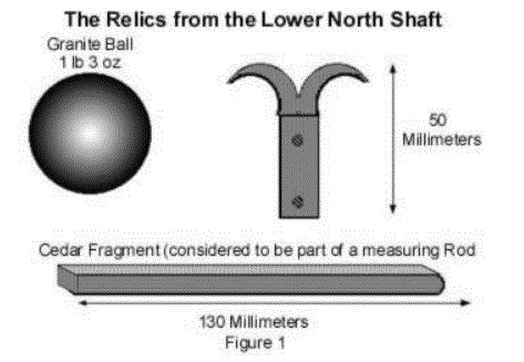
I believe that the relics shown in Figure 1, which were discovered in the North shaft of the Queens chamber in the Great Pyramid of Khufu by Waynman Dixon and DR Grant in 1872, may have been one of the greatest Egyptian treasures revealed to date. Understanding them will open all kinds of avenues of new research into the ancient past. It was Charles Piazzi Smyth in his 1878 book "The Great Pyramid" who recorded the relics found in the north shaft of the Queens chamber by Dixon and Grant. These items were found in the hermetically sealed north shaft broken into by a Bill Grundy under the direction of W Dixon. The relics were sent to Piazzi Smyth in a cigar box where they were recorded in his diary with accompanying drawings and sketches. The loss of these relics was the subject of an extensive investigationin 1993 conducted by Robert Bauval with the assistance of Dr. Mary Bruck and the late Professor I.E.S. Edwards.
These events are documented in the epilogue of his book, The Orion Mystery. In Mr. Bauval's book he mentions several times that one of these relics, the bronze hook, was probably a form of Pesh-en-kef and "also a sighting device for stellar alignments", and that this was a view that was supported by Professor I.E.S. Edwards. Bauvel also suggests in the book that, like the Czech astronomer Zaba before him, "that the Pesh-en-Kef instrument, fixed on a wooden piece and in conjunction with a plumb-bob, was used to align the pyramid to the pole stars."
Furthermore, he suggested, "it seemed very likely that a priest placed the ritualistic tools inside the northern shaft from the other side
of the wall of the Queen's Chamber." This prompted him to state further in The Orion Mystery that "we cannot help wondering if these ancient relics (were) indeed, perhaps the very sighting instruments that were used to align the Great Pyramid to the stars." (1)
Two of the objects can now be found in the British Museum.
The 1872 items consisted of a slat or rod of cedar wood about 13 centimeters long (part of a measuring rod), a granite ball weighing 1lb 3 ounces and a bronze/copper hook type of instrument, 5 centimeters long, with a part of a wooden handle still attached. The fragment of measuring rod is currently reported as missing.
No further examination of the shafts in the Queens chamber had been carried out until 1993, when Rudolf Gantenbrink developed a remarkable robot known as Uphaut 2 to explore the shafts and to install a ventilation system in the Pyramid of Khufu designed to reduce humidity within the pyramid. He was subsequently to make the most accurate internal survey of the shafts to date. This work was undertaken on behalf of the Egyptian Government with the approval of Dr. Zahi Hawass. The operation was a success and a credit to Rudolf Gantenbrink. The discoveries made were remarkable and increased our understanding of the construction of the pyramid. The robot is now in the British museum and the story of this work is public knowledge.
How is this relevant to my theory? It appears that in 1872,Waynman Dixon explored the northern shaft with an extendible iron rod.
It seems that Dixons crude rod had damaged the original artifact, from which the relics originated. This blind probing may have caused the items to become damaged and dislodged from higher in the shaft, enabling Dixon to recover them easily. On the video footage of the shaft, taken by Uphaut 2 in 1993, there can be seen the remainder of a long wooden rod from which the 13-centimeter piece had broken. What can also be seen is an object that appears to look like a rectangle of wood or metal, with two corresponding holes to match the rivets on the metal instrument. Unfortunately, Rudolf Gantenbrink was unable to explore the shaft further for technical reasons.
Having collated the information available from the relics found in 1872 and those seen in the shaft in 1993, theoretical reconstruction of the instrument can be achieved.
The items are as follows:
Recovered collection of parts
Parts recorded but missing
Parts not yet discovered
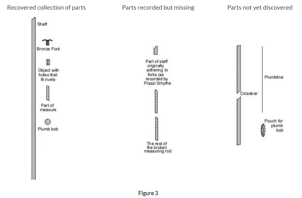
Figure 3
1872 objects:
Plumb bob
Fragment of scale rule (now missing but recorded by Piazzi Smyth)
Bronze or copper fork with fixing rivets attached.
1993 objects:
A piece of wood with holes that match the rivets on the bronze item.
A 2-meter plus length of wood resembling a staff with a portion missing.
Various pieces of unidentified material, located in two areas of the shaft.
A large rectangular object can be seen at the upper end of the shaft attached to the 2-meter length of wood.
With this component list, it is possible to assemble the known parts in a logical format.
Exploded View of the Instrument

Figure 5
Method of assembling the instrument from the component list.
1. The metal fork appears to be designed to attach to one end of the long staff by a half housed joint held by the two rivets on one side of the hook.
2. The plumb line is looped over the fork, on the top of the staff, by way of a slipknot. The working end returning over the side of the fork opposite to the scale, this allows the line to cut the apex of the joint between the cross arm and the staff precisely.
3. A pouch or net is fixed to the opposite end of the plumb line, to hold the plumb bob.
4. A cross bar is mounted on the fork, at right angles to the staff and fixed with the remaining two rivets at the front of the instrument. (I believe that this is the purpose of the object with two corresponding holes still in the shaft)
5. One end of a measuring rod is fixed at 45o to one arm of the cross bar.
6. The other end of the measuring rod is fixed at 45o to the upright of the staff.
Assembled view of the Instrument
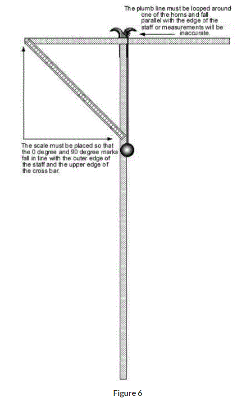
Figure 6
Having completed the initial assembly and understanding the principles of the instrument earlier outlined, it can be established what components are missing to complete the instrument and turn it into a working model, proving the hypothesis.
Measuring Rods
Proof that the Egyptians had sufficient knowledge of decimals and degrees to allow construction of the measuring rod has already been proved and published by Sir William Flanders Petrie when he surveyed the Pyramid of Khufu, where he stated that the Royal Cubit measured 523.95 millimeters or 20.6 inches. It was established that Fourth Dynasty builders divided the cubit into decimals. Sir William also named a unit of measurement used at Giza as a digit, which is constantly accurate to one tenth of a millimeter:
1.75752 cubits = 9180 digits = 918 millimeters = 90 centimeters approximately.
This is sufficiently close enough for centimeters and millimeters to represent degrees and minutes for the purposes of this experiment.
Exponential Scale
Extreme accuracy for the time of three arc minutes would be achieved by the development of an exponential scale. This is achieved by drawing lines from the center point of a circle outward, through the rule. This can be seen in figure 7, kindly provided by Jim Bowles.
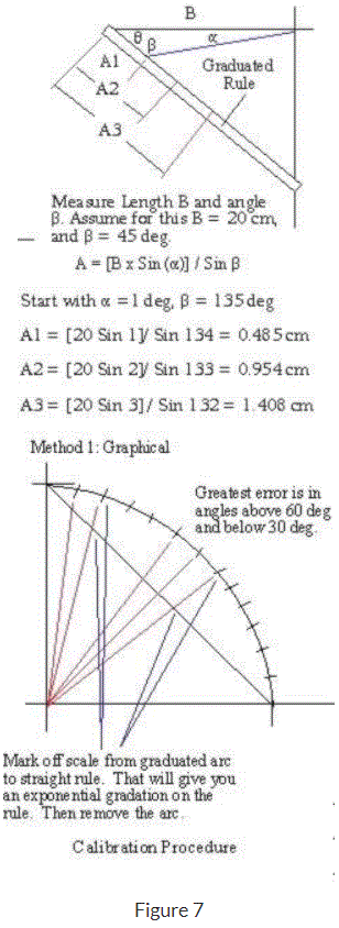
Figure 7
Evidence of Tools
Sir William Petrie also established that no tools would be discovered and described the reasons why. The tools were sacred and belonged to the Royal Family; losing one was a serious crime and could have resulted in the loss of life for the unfortunate individual at fault. The use of the types of tools employed in the construction was through analysis of the marks on the stone, therefore it was possible to deduce that there was metal in the tools used, as indicated by the evidence left in the cuts. According to Sir William Flanders Petrie, bronze and copper saws and drills of various designs were employed. Some used precious stones for tips and accordingly would have been very valuable.
Secrecy
I believe that these tools were owned by Master Craftsmen, practicing in Guilds and that their tools and skills were precious to them, much as they were by later generations of craftsmen employed during the Great Cathedral building age in Europe. I further believe that this instrument is tangible proof of the Ancient Egyptians depth of knowledge in the disciplines of astronomy, surveying and navigation, hitherto underestimated. And I believe that this knowledge may have been practiced by members of craft guilds, in secret, right up to the age of Cathedral building in Europe. The knowledge may have been kept secret for two reasons.
1- That the Trade Guild or Society members were sworn to secrecy after or during their apprenticeship, so as to protect their knowledge from the uninitiated.
2- That there was persecution, even to death, by the religious powers during certain historical periods, who would allow no dealing with astronomy or other "occult practices".
Finally, I believe that the Christian Cross originated from an instrument used by the craftsmen in ancient Egypt and possibly other more ancient civilizations such as the Neolithic Peoples.
Figure 8
This photograph is provided with the kind permission of Maureen Palmer and shows the parts of the instruments in the Temple of Horus at Edfu. These hieroglyphs probably are Ptolemaic in origin.
I think that the relics discovered by Dixon in the Queens chamber, were part of an originally complete instrument that had been sealed into the pyramid by the architects, in the same manner that masons and craftsmen made their mark on their stone masterpieces. This tradition is carried forward to this day and is usually found in foundation and corner stones of buildings.
Applications
I intend to show that in the hands of a skilled and knowledgeable operator, this simple instrument can be used for the following purposes:
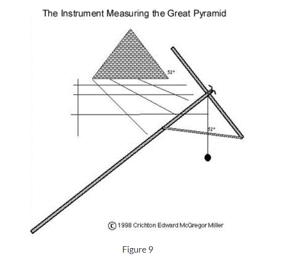
Figure 9
This illustration demonstrates the ability of the Instrument to measure angles accurately.
1. The Instrument can be used to take remarkably accurate astronomical measurements.
2. Measuring distances for chart and map making including measuring the circumference of the Earth, to an accuracy of 3 arc minutes.
3. The Instrument can be used for Civil engineering projects such as surveying and construction.
4. Timekeeping and the calendar upkeep are possible with this instrument.
5. Navigation including latitude to an accuracy of 3 nautical miles on a handheld version.
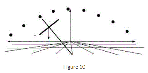
Figure 10
This diagram shows the unique ability of the instrument to take sidereal angular measurements of the movement of astronomical bodies.
With the knowledge of local time coupled with a rudimentary knowledge of astronomy, it is possible to find both latitude and longitude with this instrument.
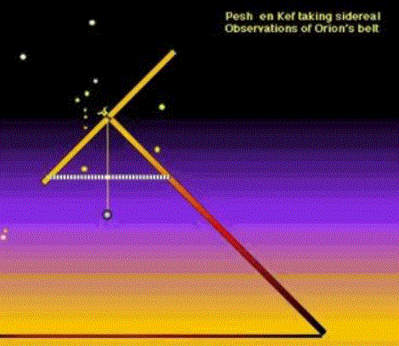
Figure 11
This example shows the use of the bronze fork. If an observer uses the cleft in the fork to sight the star at night, it would be difficult to see without a polished and reflective surface.
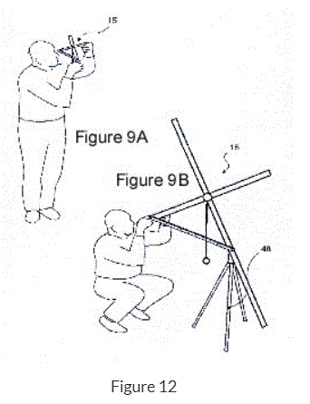
Figure 12
This example of a cross type of instrument shows how linear angles can be found with the addition of an effective scale set at 45 degrees to the upright and cross bars. The tripod at the foot of the assembly, adds stability. This particular instrument at this size would have an accuracy of 3 arc minutes. The illustration was taken from UK Patent No. GB 2 344 654 A
The following example is a tutorial for finding latitude with the instrument using the current pole star of Polaris.
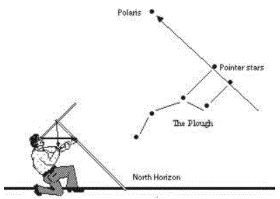
To find latitude at night, clear skies permitting, one must first find the pole star. the North pole star is currently Polaris and is found by first locating the constellation known as the Plough or Big Dipper. The Plough constantly revolves around Polaris in an anti clockwise direction when viewed in northern latitudes. The two stars at the outer edge of the Big Dipper are known as the pointer stars. By following the pointer stars as in the drawing, the next star that is seen in line with the pointer stars is Polaris. By pointing the instrument at Polaris and reading off the degrees from the scale, one is able to find one's latitude directly. this is because when pointing the cross bar at the pole star the view is a parallax due to the great distance of the body being observed.
The plumb line will always point to the earth's center can be observed. The nature of the instrument being in the shape of a cross and scale mounted on the opposite side allows the opposite angle to that of the actual angle between star and the earth's center to be measured. The smaller resulting angle is equivalent to the 90 degrees of latitude from the equator to the pole.
As the observer moves toward the pole following the curvature of the earth, the instrument will tilt further back increasing the angle. By moving toward the equator, the angle will decrease. Therefore, the angle can be measured directly from the scale and the latitudinal position obtained.
Figure 13
This figure shows how accurately a modern observer can find latitude with this instrument. Polaris was not the pole star at the time of the building of the Pyramid of Khufu. Because of the effect of precession, the polar region has moved to its present position. It is, however, possible to find a meridian with this instrument, both day and night.
The system works by interpolating the declination of an astronomical body with the use of equal altitude observations. This is only possible with an instrument of this type.
Earth Circumference Measurements
It is possible to take complete spherical measurements in every plane with the instrument. If one uses it as an inclinometer, (sextant) a hand held variant with a scale of 900 millimeters can be accurate to 3 arc minutes or 3 nautical miles as measured on the meridian.
Any passage, land or sea,tracking true north for units of this distance, will allow simple interpolation that shows the approximate circumference of the Earth on meridians (not allowing for the planet being an oblate spheroid). In other words, the circumference of the earth can be fairly worked out by traveling only 6 nautical miles, whilst taking regular observations.
The unique feature of the instrument, however, is that it is capable of sidereal or horizontal measurements. This is beyond the scope of a sextant and the reason why I was granted a patent on the instrument. It means that one is able to take measurements of ecliptic constellations as they track from east to west horizons. One must find latitude first and be aware of thedeclination of the ecliptic at the time of observation.
For instance:
In our epoch, at the winter solstice,at midnight at any position on the globe, Orion is due south and the ecliptic stars aredirectly overhead at 23.4o north latitude as translated onto the planet. True Northis found first by sighting the pole star and correcting for local latitude.True southis thencalculated by measurements on a single bodyof equal altitude, interpolated,as it passeseither side of the chosen meridian.
Constellation Stars on the eclipticare measured by sidereal observation to equal minutes of arc adding up to individual degrees. Each constellation Taurus to the east and Gemini to the west is 30 degrees long or 1800nautical miles translated onto the Earth's surface. These two constellations represent 3600 nautical miles. Twelve of these represent 21600 nautical miles. And there you have it, the Earth's circumference.
Solar observations
The instrument is capable of taking solar observations and measuring declination and Hour angles. This is achieved by indirectly viewing the sun. The instrument is directed at the sun and the shadow is projected onto a horizontal surface. By aligning the cross bar toward the sun an accurate shadow image can be read, and the degrees read from the scale.
(Update)
The instrument was granted a Patent by The United Kingdom Patents Office under Patent No GB 2344887 after extensive worldwide searches and publications. The Patent was granted in November 2000 .
The patent was granted because the instrument was not "obvious" in that it had two unique features not available to any instrument in the world today.
The ability to take sidereal (horizontal) angular observations.
The use of a fulcrum for steadiness and accuracy.
This work, to all intents and purposes, has been peer reviewed and published accordingly.
Please visit Crichton E. M. Miller's home page at http://www.crichtonmiller.com for information on this and other topics.
You may write Paul at PFG88@aol.com with any questions or comments.
They found some of the cross pieces in a buried cigar box a few years back:
https://www.independent.co.uk/news/uk/sacred-egyptian-relics-said-to-lie-under-the-needle-objects-taken-from-the-great-pyramid-121-years-ago-may-be-buried-beside-the-thames-david-keys-reports-1465683.html
This paper has a mention of the "merkhet" (measuring rod with line) and the measures used in Ancient Egypt: https://www.fig.net/resources/proceedings/fig_proceedings/cairo/papers/wshs_02/wshs02_02_paulson.pdf
Cross Staff and Plumb line and the Great Pyramid
The Golden Thread of Time, 2001
Revealing the possible re discovery of a geometrical, spherical measuring instrument in the Pyramid of Khufu known as the Dixon Relics, held in the British Museum and Aberdeen By Crichton E M Miller FCILT This advanced protractor, similar to the cross and plumb line, is an advanced mathematical device, capable of astronomy, navigation and surveying. It is proposed, that the ancient Egyptian architects and astronomers used this hybrid Celtic cross, for the purposes of stellar alignment and timekeeping.
Miles' paper:
354. A Preliminary Study of the Pyramid as an Electrical Structure. Applying the foundational E/M field to the problem of the pyramid, in a strictly mechanical analysis. 10pp.
http://milesmathis.com/pyramid.html
Always thought the Pyramids were built to work as giant Ionizers that could possibly power rain on-demand by the temple priests. There were thousands of round oval disks with three holes in them to allow for holding water near the pyramids after getting diverted from the nearby Nile river. I don't know if there are any drawn pictographs in the Pyramids demonstrating this though. The Pyramids used to be covered with polished granite and had a copper-top pyrimidion. If the edges also had copper lines, then it could work with Miles' explanation of the Charge Field-E/M in play.
----------
Cross Staff and Plumbline and the Great Pyramid
Revealing the discovery of a geometrical, spherical measuring instrument in the Pyramid of Khufu
By Crichton E M Miller
This advanced protractor, similar to the cross and plumb line, is an advanced mathematical device, capable of astronomy, navigation and surveying. It is proposed, that the ancient Egyptian architects and astronomers used this hybrid Celtic cross, for the purposes of stellar alignment and timekeeping.
The proposal and thesis is based upon the discoveries and calculations of the author, whilst working on the proposal that the Celtic cross was an instrument derived from the astrolabe and quadrant. That the Celtic cross was used as a spherical measuring instrument for the purposes of navigation, astronomy, surveying, cartography and time keeping is known. Since there is, and has been, much debate amongst groups of academics over the ancient methods of surveying the pyramids at Giza, we will attempt to address the following questions.
How did the ancient architects survey and lay out the constructions?
How did the architects achieve alignment?
Were the alignments achieved by solar or stellar observation?
How did the architects achieve such accuracy?
What instrument did they use?
It is known that the ancient Egyptians used plumb line technology in several different areas, particularly in weights and measures. This is depicted in many friezes and was used in surveying, with the instruments known as the Bay and Merkhet. What has not been found to date, is an instrument capable of acting as an inclinometer or modern theodolite / sextant. Not only that, but one that is accurate to degrees and fractions of degrees, which would be necessary for the ancients calculations.
Degrees are broken down into minutes and seconds of arc. One minute of arc is equal to one nautical mile on the meridian.
1. The proposal is that the pyramid of Khufu was surveyed with an instrument capable of accuracy to 3 minutes of arc.
2. That the evidence of the use of this instrument, is not only in the constructions, but that the author has found evidence of the actual artifact.
The Evidence
I believe that the relics shown in Figure 1, which were discovered in the North shaft of the Queens chamber in the Great Pyramid of Khufu by Waynman Dixon and DR Grant in 1872, may have been one of the greatest Egyptian treasures revealed to date. Understanding them will open all kinds of avenues of new research into the ancient past. It was Charles Piazzi Smyth in his 1878 book "The Great Pyramid" who recorded the relics found in the north shaft of the Queens chamber by Dixon and Grant. These items were found in the hermetically sealed north shaft broken into by a Bill Grundy under the direction of W Dixon. The relics were sent to Piazzi Smyth in a cigar box where they were recorded in his diary with accompanying drawings and sketches. The loss of these relics was the subject of an extensive investigationin 1993 conducted by Robert Bauval with the assistance of Dr. Mary Bruck and the late Professor I.E.S. Edwards.
These events are documented in the epilogue of his book, The Orion Mystery. In Mr. Bauval's book he mentions several times that one of these relics, the bronze hook, was probably a form of Pesh-en-kef and "also a sighting device for stellar alignments", and that this was a view that was supported by Professor I.E.S. Edwards. Bauvel also suggests in the book that, like the Czech astronomer Zaba before him, "that the Pesh-en-Kef instrument, fixed on a wooden piece and in conjunction with a plumb-bob, was used to align the pyramid to the pole stars."
Furthermore, he suggested, "it seemed very likely that a priest placed the ritualistic tools inside the northern shaft from the other side
of the wall of the Queen's Chamber." This prompted him to state further in The Orion Mystery that "we cannot help wondering if these ancient relics (were) indeed, perhaps the very sighting instruments that were used to align the Great Pyramid to the stars." (1)
Two of the objects can now be found in the British Museum.
The 1872 items consisted of a slat or rod of cedar wood about 13 centimeters long (part of a measuring rod), a granite ball weighing 1lb 3 ounces and a bronze/copper hook type of instrument, 5 centimeters long, with a part of a wooden handle still attached. The fragment of measuring rod is currently reported as missing.
No further examination of the shafts in the Queens chamber had been carried out until 1993, when Rudolf Gantenbrink developed a remarkable robot known as Uphaut 2 to explore the shafts and to install a ventilation system in the Pyramid of Khufu designed to reduce humidity within the pyramid. He was subsequently to make the most accurate internal survey of the shafts to date. This work was undertaken on behalf of the Egyptian Government with the approval of Dr. Zahi Hawass. The operation was a success and a credit to Rudolf Gantenbrink. The discoveries made were remarkable and increased our understanding of the construction of the pyramid. The robot is now in the British museum and the story of this work is public knowledge.
How is this relevant to my theory? It appears that in 1872,Waynman Dixon explored the northern shaft with an extendible iron rod.
It seems that Dixons crude rod had damaged the original artifact, from which the relics originated. This blind probing may have caused the items to become damaged and dislodged from higher in the shaft, enabling Dixon to recover them easily. On the video footage of the shaft, taken by Uphaut 2 in 1993, there can be seen the remainder of a long wooden rod from which the 13-centimeter piece had broken. What can also be seen is an object that appears to look like a rectangle of wood or metal, with two corresponding holes to match the rivets on the metal instrument. Unfortunately, Rudolf Gantenbrink was unable to explore the shaft further for technical reasons.
Having collated the information available from the relics found in 1872 and those seen in the shaft in 1993, theoretical reconstruction of the instrument can be achieved.
The items are as follows:
Recovered collection of parts
Parts recorded but missing
Parts not yet discovered
Figure 3
1872 objects:
Plumb bob
Fragment of scale rule (now missing but recorded by Piazzi Smyth)
Bronze or copper fork with fixing rivets attached.
1993 objects:
A piece of wood with holes that match the rivets on the bronze item.
A 2-meter plus length of wood resembling a staff with a portion missing.
Various pieces of unidentified material, located in two areas of the shaft.
A large rectangular object can be seen at the upper end of the shaft attached to the 2-meter length of wood.
With this component list, it is possible to assemble the known parts in a logical format.
Exploded View of the Instrument
Figure 5
Method of assembling the instrument from the component list.
1. The metal fork appears to be designed to attach to one end of the long staff by a half housed joint held by the two rivets on one side of the hook.
2. The plumb line is looped over the fork, on the top of the staff, by way of a slipknot. The working end returning over the side of the fork opposite to the scale, this allows the line to cut the apex of the joint between the cross arm and the staff precisely.
3. A pouch or net is fixed to the opposite end of the plumb line, to hold the plumb bob.
4. A cross bar is mounted on the fork, at right angles to the staff and fixed with the remaining two rivets at the front of the instrument. (I believe that this is the purpose of the object with two corresponding holes still in the shaft)
5. One end of a measuring rod is fixed at 45o to one arm of the cross bar.
6. The other end of the measuring rod is fixed at 45o to the upright of the staff.
Assembled view of the Instrument
Figure 6
Having completed the initial assembly and understanding the principles of the instrument earlier outlined, it can be established what components are missing to complete the instrument and turn it into a working model, proving the hypothesis.
Measuring Rods
Proof that the Egyptians had sufficient knowledge of decimals and degrees to allow construction of the measuring rod has already been proved and published by Sir William Flanders Petrie when he surveyed the Pyramid of Khufu, where he stated that the Royal Cubit measured 523.95 millimeters or 20.6 inches. It was established that Fourth Dynasty builders divided the cubit into decimals. Sir William also named a unit of measurement used at Giza as a digit, which is constantly accurate to one tenth of a millimeter:
1.75752 cubits = 9180 digits = 918 millimeters = 90 centimeters approximately.
This is sufficiently close enough for centimeters and millimeters to represent degrees and minutes for the purposes of this experiment.
Exponential Scale
Extreme accuracy for the time of three arc minutes would be achieved by the development of an exponential scale. This is achieved by drawing lines from the center point of a circle outward, through the rule. This can be seen in figure 7, kindly provided by Jim Bowles.
Figure 7
Evidence of Tools
Sir William Petrie also established that no tools would be discovered and described the reasons why. The tools were sacred and belonged to the Royal Family; losing one was a serious crime and could have resulted in the loss of life for the unfortunate individual at fault. The use of the types of tools employed in the construction was through analysis of the marks on the stone, therefore it was possible to deduce that there was metal in the tools used, as indicated by the evidence left in the cuts. According to Sir William Flanders Petrie, bronze and copper saws and drills of various designs were employed. Some used precious stones for tips and accordingly would have been very valuable.
Secrecy
I believe that these tools were owned by Master Craftsmen, practicing in Guilds and that their tools and skills were precious to them, much as they were by later generations of craftsmen employed during the Great Cathedral building age in Europe. I further believe that this instrument is tangible proof of the Ancient Egyptians depth of knowledge in the disciplines of astronomy, surveying and navigation, hitherto underestimated. And I believe that this knowledge may have been practiced by members of craft guilds, in secret, right up to the age of Cathedral building in Europe. The knowledge may have been kept secret for two reasons.
1- That the Trade Guild or Society members were sworn to secrecy after or during their apprenticeship, so as to protect their knowledge from the uninitiated.
2- That there was persecution, even to death, by the religious powers during certain historical periods, who would allow no dealing with astronomy or other "occult practices".
Finally, I believe that the Christian Cross originated from an instrument used by the craftsmen in ancient Egypt and possibly other more ancient civilizations such as the Neolithic Peoples.
Figure 8
This photograph is provided with the kind permission of Maureen Palmer and shows the parts of the instruments in the Temple of Horus at Edfu. These hieroglyphs probably are Ptolemaic in origin.
I think that the relics discovered by Dixon in the Queens chamber, were part of an originally complete instrument that had been sealed into the pyramid by the architects, in the same manner that masons and craftsmen made their mark on their stone masterpieces. This tradition is carried forward to this day and is usually found in foundation and corner stones of buildings.
Applications
I intend to show that in the hands of a skilled and knowledgeable operator, this simple instrument can be used for the following purposes:
Figure 9
This illustration demonstrates the ability of the Instrument to measure angles accurately.
1. The Instrument can be used to take remarkably accurate astronomical measurements.
2. Measuring distances for chart and map making including measuring the circumference of the Earth, to an accuracy of 3 arc minutes.
3. The Instrument can be used for Civil engineering projects such as surveying and construction.
4. Timekeeping and the calendar upkeep are possible with this instrument.
5. Navigation including latitude to an accuracy of 3 nautical miles on a handheld version.
Figure 10
This diagram shows the unique ability of the instrument to take sidereal angular measurements of the movement of astronomical bodies.
With the knowledge of local time coupled with a rudimentary knowledge of astronomy, it is possible to find both latitude and longitude with this instrument.
Figure 11
This example shows the use of the bronze fork. If an observer uses the cleft in the fork to sight the star at night, it would be difficult to see without a polished and reflective surface.
Figure 12
This example of a cross type of instrument shows how linear angles can be found with the addition of an effective scale set at 45 degrees to the upright and cross bars. The tripod at the foot of the assembly, adds stability. This particular instrument at this size would have an accuracy of 3 arc minutes. The illustration was taken from UK Patent No. GB 2 344 654 A
The following example is a tutorial for finding latitude with the instrument using the current pole star of Polaris.
To find latitude at night, clear skies permitting, one must first find the pole star. the North pole star is currently Polaris and is found by first locating the constellation known as the Plough or Big Dipper. The Plough constantly revolves around Polaris in an anti clockwise direction when viewed in northern latitudes. The two stars at the outer edge of the Big Dipper are known as the pointer stars. By following the pointer stars as in the drawing, the next star that is seen in line with the pointer stars is Polaris. By pointing the instrument at Polaris and reading off the degrees from the scale, one is able to find one's latitude directly. this is because when pointing the cross bar at the pole star the view is a parallax due to the great distance of the body being observed.
The plumb line will always point to the earth's center can be observed. The nature of the instrument being in the shape of a cross and scale mounted on the opposite side allows the opposite angle to that of the actual angle between star and the earth's center to be measured. The smaller resulting angle is equivalent to the 90 degrees of latitude from the equator to the pole.
As the observer moves toward the pole following the curvature of the earth, the instrument will tilt further back increasing the angle. By moving toward the equator, the angle will decrease. Therefore, the angle can be measured directly from the scale and the latitudinal position obtained.
Figure 13
This figure shows how accurately a modern observer can find latitude with this instrument. Polaris was not the pole star at the time of the building of the Pyramid of Khufu. Because of the effect of precession, the polar region has moved to its present position. It is, however, possible to find a meridian with this instrument, both day and night.
The system works by interpolating the declination of an astronomical body with the use of equal altitude observations. This is only possible with an instrument of this type.
Earth Circumference Measurements
It is possible to take complete spherical measurements in every plane with the instrument. If one uses it as an inclinometer, (sextant) a hand held variant with a scale of 900 millimeters can be accurate to 3 arc minutes or 3 nautical miles as measured on the meridian.
Any passage, land or sea,tracking true north for units of this distance, will allow simple interpolation that shows the approximate circumference of the Earth on meridians (not allowing for the planet being an oblate spheroid). In other words, the circumference of the earth can be fairly worked out by traveling only 6 nautical miles, whilst taking regular observations.
The unique feature of the instrument, however, is that it is capable of sidereal or horizontal measurements. This is beyond the scope of a sextant and the reason why I was granted a patent on the instrument. It means that one is able to take measurements of ecliptic constellations as they track from east to west horizons. One must find latitude first and be aware of thedeclination of the ecliptic at the time of observation.
For instance:
In our epoch, at the winter solstice,at midnight at any position on the globe, Orion is due south and the ecliptic stars aredirectly overhead at 23.4o north latitude as translated onto the planet. True Northis found first by sighting the pole star and correcting for local latitude.True southis thencalculated by measurements on a single bodyof equal altitude, interpolated,as it passeseither side of the chosen meridian.
Constellation Stars on the eclipticare measured by sidereal observation to equal minutes of arc adding up to individual degrees. Each constellation Taurus to the east and Gemini to the west is 30 degrees long or 1800nautical miles translated onto the Earth's surface. These two constellations represent 3600 nautical miles. Twelve of these represent 21600 nautical miles. And there you have it, the Earth's circumference.
Solar observations
The instrument is capable of taking solar observations and measuring declination and Hour angles. This is achieved by indirectly viewing the sun. The instrument is directed at the sun and the shadow is projected onto a horizontal surface. By aligning the cross bar toward the sun an accurate shadow image can be read, and the degrees read from the scale.
(Update)
The instrument was granted a Patent by The United Kingdom Patents Office under Patent No GB 2344887 after extensive worldwide searches and publications. The Patent was granted in November 2000 .
The patent was granted because the instrument was not "obvious" in that it had two unique features not available to any instrument in the world today.
The ability to take sidereal (horizontal) angular observations.
The use of a fulcrum for steadiness and accuracy.
This work, to all intents and purposes, has been peer reviewed and published accordingly.
Please visit Crichton E. M. Miller's home page at http://www.crichtonmiller.com for information on this and other topics.
You may write Paul at PFG88@aol.com with any questions or comments.
Chromium6- Posts : 740
Join date : 2019-11-29
Re: Doggerland as Atlantis? Perhaps?
![]() by Chromium6 Mon Jun 26, 2023 1:18 am
by Chromium6 Mon Jun 26, 2023 1:18 am
Was looking at this recently. I don't know if they are related (older to the younger).
-------------
Hugh Crichton-Miller (1877-1959)
Found among the papers of L R Reeve* this appreciation of the life of Dr Hugh Crichton Miller Scottish psychiatrist and founder of the Tavistock Clinic.
Tavistock Clinic**
DR HUGH CRICHTON-MILLER
My appreciation of the late Dr Hugh Crichton-Miller is not in chronological order so I begin with an unusual admonition made in the middle of one of his talks to an audience of highly intelligent and respectful graduates: If you can't study the subject deeply leave psycho-analysis alone'.
His advice has never left my memory for two reasons: the very level-headed doctor was one of our greatest authorities on medical psychology, and a few weeks later the matron of a nursing home, having asked my opinion of the new psychology informed me that treatment was beneficial to half the patients concerned and disastrous to the others. Hence I was warned and I feel to-day that the warning is more imperative than ever before, not only to myself but to the increasing number of people concerned.
However, as psycho-analysis is not on my own terms of reference I refer to my next view of the specialist on the platform in Wimpole Street, when he so ably interpreted Dr Montessori's address. I have mentioned him in my reference to Montessori elsewhere so turn to my third episode when I heard him at the seaside.
If there remains a more compelling speaker than was Crichton-Miller I have no burning desire to listen to him. Not so long after the first world war a different lecturer arrived each evening to address the Summer School of Psychology at Brighton. Crichton-Miller appeared one evening, and at the end of the refresher course it was agreed that his contribution was the best of all. His style was not that of a running commentator; at infrequent times he was searching for the right word, something like the late Sir Austin Chamberlain, although the pauses were not so prolonged. Very occasionally there was a suggestion of unease. All the same there was a charm in his quiet intensity, every word could be heard, there were no dramatic gestures, only a dullard would be unaware of his meaning, and he had a magnetic influence on his audience.
He was born in Genoa. His father was the Rev. Donald Miller, D.D., and I am sure I have read somewhere that the father's house was unofficially the centre of the British community in that historic area. In his early days Crichton-Miller was educated at Fettes College, Edinburgh, followed by a period at Edinburgh University where he was, I find, President of the University Union: a significant indication of an outstanding student. I haven't yet met an ex-president of any university union whose personality isn't above the average; besides, I have known two of his Edinburgh contemporaries who were themselves outstanding men. I must add too that Pavia University can claim him as a distinguished son where he achieved another doctorate.
So much for his formal education: which I am sure is incomplete in the telling; and his high offices are too numerous to present a comprehensive account; therefore I am leaving out some of his responsible activities, among which were House Surgeon and House Physician, Royal Infirmary, Edinburgh, general practice, San Remo, Italy and Aviemore, Invernisshire, officer in charge functional cases, 21st General Hospital, Egypte, plus several responsible office in various areas.
Yet, possibly his chief claims to fame concern his establishment Bowden House, at Harrow-on-the-Hill, a centre for the treatment of psychiatric disorders, and his international reputation as founder of the Tavistock Clinic, a curative centre for mental disturbances. Ex-patients will remember his successful treatment with gratitude for many years; his curative methods will be a tradition for a number of generations. Men of his great achievement are hard to forget.
As for his thoughtful publications and well-presented conclusions, some of them will be accepted for many years as classics and the final authority among doctors and teachers. Among his six books 'The New Psychology and the Teacher', 'Psycho-analysis and its Derivatives' must be useful not only for students, but for any adult interested in human conduct. Further, not too busy to write half a dozen professional publications he found time to write many articles and essays in various medical journals; and I can believe that probably his greatest service to medicine is due to his faultless knowledge of the Italian language.
After many years of reading, or hearing, of seeing an unusually attractive and deep-thinking medical man I have arrived. with temerity, at two theories: that his interest in the educational side of psychology was nearly as great as his absorption in medical science. Then at times he quietly entered a meeting the education section of the British Psychological Society, listened intently to a paper and the subsequent discussion between such leading figures as Sir Cyril Burt, Dr Ballard, Sir Percy Nunn and Susan Isaacs, and left without expressing an opinion. My second impression makes me feel lyrical. It seems to me that from his early days in rompers to his last breath his family life was unusually happy. His parents, brother and sisters fitted easily into a mutually tolerant parent-child relationship, and later he and Mrs Crichton Miller in turn were very happy with responsive, cheerful progeny. During the second world war there was a photograph in a daily paper of the doctor with two or three charming daughters in service uniform. Maybe the proud father was wore his uniform too. I am not sure. But it is certain I have never seen a happier little group for many a long day.
His protracted illness, borne with fortitude, ended when he was eighty-two. Friends and admirers alike miss his stimulating presence; family anguish must at first have been enormous; but he left his eminent son Donald and his daughters a priceless inheritance which must have been a great consolation, and which they will always treasure above wealth: proud memories.
* Found among the papers of the long defunct literary agency Michael Hayes of Cromwell Road S.W.5 - parts of a manuscript memoir by one L.R. Reeve of Newton Abbot, South Devon. Mr Reeve was attempting to get the book (Among those Present: Very Exceptional People) published, but on the evidence of the unused stamp Hayes never replied and L. R. Reeve published the book himself through the esteemed vanity publisher Stockwell two years later in 1974.
L R Reeve had in a long life met or observed a remarkable selection of famous persons. He presents 'vignettes' of 110 persons from all grades of society (many minor or even unknown) they include Winston Churchill, Dorothy Sayers, H H Asquith, John Buchan, the cricketer Jack Hobbs, J.B. Priestley, H.G. Wells, Marconi, E.M. Forster, Duchess of Atholl, Marie Stopes, Oliver Lodge and Cecil Sharp -- 'it is unnecessary to explain that many I have known have not known me. All of them I have seen, most of them I have heard, and some of them have sought information, even advice from me." Reeve states that the unifying qualification all these people have is '… some subtle emanation of personality we call leadership, and which can inspire people to actions unlikely to be undertaken unless prompted by a stronger will."
Reeve was a teacher throughout his life and deputy head of 3 London schools, headmaster of Loughborough emergency schools, ex-president of London Class Teachers Association and very early member of the British Psychological Society (55 years)... I calculate he was probably born in about 1900. His style is markedly unexciting but he has much information unavailable elsewhere.. He sent 6 typed manuscripts to (from the smell) the chain-smoking agent Hayes…
** Statue of Freud in front of the Tavistock Clinic. Photo by Mike Peel for which much thanks.
https://jot101.com/2015/01/hugh-crichton-miller-1877-1959/
This more current on the author Michael Crichton: https://digitalcommons.calpoly.edu/cgi/viewcontent.cgi?article=1012&context=comm_fac
Chromium6- Posts : 740
Join date : 2019-11-29
Miles Mathis' Charge Field :: Miles Mathis Charge Field :: Scientific Discoveries :: Just Out there....
Page 1 of 1
Permissions in this forum:
You cannot reply to topics in this forum|
|
|